

A Break in the Action
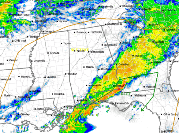
It was a very wet night across the state of Alabama. The bulk of the heavy rain and thunderstorms is pushing out of the state. Severe weather remains a threat along the northeastern Gulf Coast, where the SPC maintains a slight risk for severe weather for the areas outlined in green.
For most of Alabama, we are seeing a break in the activity. The main area of low pressure and front remain off to our west. We are even seeing a few breaks in the clouds off to our southwest and portions of Central Alabama will likely see some peeks of sunshine this afternoon. Until the main front passes through the state, we will maintain a chance for scattered showers and a few storms this afternoon.
The latest day one convective outlook from the SPC suggest areas that receive daytime heating because of the breaks in the clouds, could see some additional destabilization of the atmosphere. This could possibly allow a few isolated storms to develop later today. We will have to watch these storms carefully because the added instability may possibly allow a few of the storms to produce hail and some gusty winds.
Category: Alabama's Weather
About the Author (Author Profile)
Macon, Georgia Television Chief Meteorologist, Birmingham native, and long time Contributor on AlabamaWX. Stormchaser. I did not choose Weather, it chose Me. College Football Fanatic. @Ryan_StinnetSubscribe
If you enjoyed this article, subscribe to receive more just like it.


