

Watching the Weather to the West
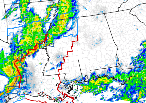
We continue to monitor the situation to our west. Widespread and organized severe weather is ongoing across the Lower Mississippi Valley. Severe thunderstorm, outlined in blue, and tornado, outlined in red, watches have been issued as far east as the the Mississippi/Alabama state line. Numerous severe weather warnings are in effect across the region.
Heading through the overnight hours, this activity will continue to head east and will be entering Alabama most likely after midnight. Because of today’s earlier rain and storm activity over the state, the atmosphere over Alabama is very stable. There is almost no surface based CAPE across the state and this will affect storms as they move into the area later. Storms are likely to remain severe across Mississippi, but by the time they enter Alabama, do to the lack of instability, the storms will weaken.
For the overnight hours, we will see widespread showers and thunderstorms, but severe weather is not expect across the state. We will see some strong storms with gusty winds and hail possible, but the better dynamics and instability for severe weather are just to west of the state. We will continue to monitor the situation as we head through the overnight hours.
Category: Alabama's Weather
About the Author (Author Profile)
Macon, Georgia Television Chief Meteorologist, Birmingham native, and long time Contributor on AlabamaWX. Stormchaser. I did not choose Weather, it chose Me. College Football Fanatic. @Ryan_StinnetSubscribe
If you enjoyed this article, subscribe to receive more just like it.


