

Storms Dropping Southward
Storms are dropping southward tonight across North Central Alabama. They seem to be getting stronger.
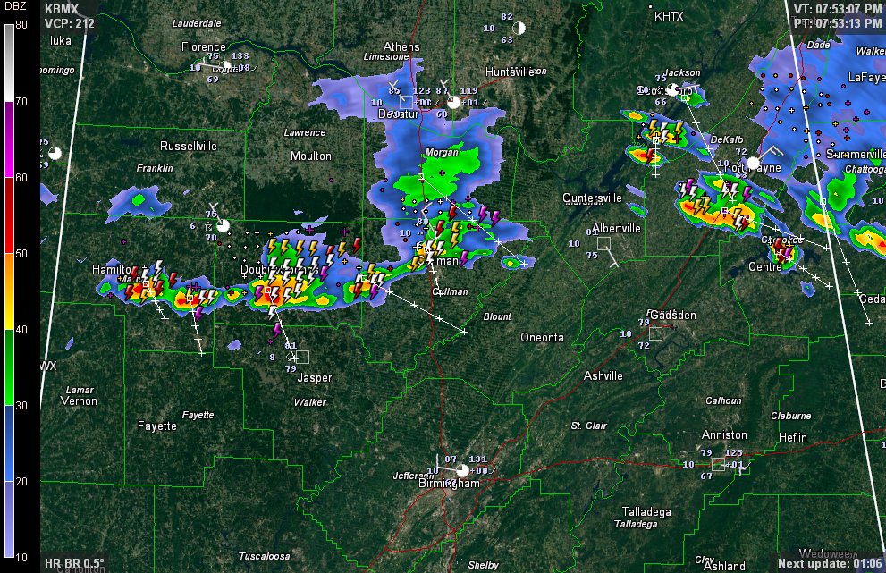
They are not severe but the NWS Birmingham has issued a significant weather alert for Winston County.
The stronger cells were located from east of Hamilton, south of Double Springs, north of Cullman and in Northeast Alabama, which has been a favored location for storms the past couple of days. In Northeast Alabama, stronger cells were over southern Jackson, DeKalb and Cherokee Counties near Cedar Bluff.
Everything is moving southeast at 15 mph.
As they approach, be ready for lots and lots of lightning, strong gusty winds and torrential rain.
In northern Mississippi, there is a tornado warning now for Panola county for a storm southeast of Senatobia.
Category: Alabama's Weather
About the Author (Author Profile)
Bill Murray is the President of The Weather Factory. He is the site's official weather historian and a weekend forecaster. He also anchors the site's severe weather coverage. Bill Murray is the proud holder of National Weather Association Digital Seal #0001 @wxhistorianSubscribe
If you enjoyed this article, subscribe to receive more just like it.


