

Arthur in the Days Ahead?
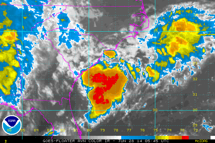
We have been keeping our eye on low pressure that had been forecast to develop off the South Carolina coast over the past couple of days. That did happen and the system is sitting over very warm Gulf Stream waters with temperatures conducive to tropical development. Significant thunderstorm development has occurred this morning with the system and it does appear there is some chance for tropical development as the system moves south over the next couple of days.
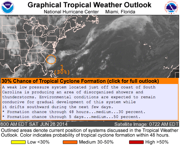
The NHC has upgraded the probability of development over the short term (48 hours) and the medium term 96 hours) to 30% and 50% respectively.
It is now called Invest 91L, the cryptic way that the NHC uses to identify tropical disturbances of interest.
So we could see a tropical depression form sometime today or tomorrow from this system. There is some chance that it could become a tropical storm, especially if it turns back to the northeast and tracks over that same Gulf Stream to the Outer Banks. It it does, it would be Arthur.
The Canadian model carries it slowly southwestward before turning it easterly. This idea is discounted for now.
The European carries it to a point east of Melbourne on the East Coast of Florida by early Monday, and sits it there through midweek before moving it back to the northeast to near the Outer Banks of North Carolina by Friday night and off to the northeast after that. It develops it into a pretty decent tropical storm or hurricane, but doesn’t affect any of the rest of the U.S. coastline. This is a viable idea.
The GFS carries it down to east of the Florida Peninsula but weakens it there and never really develops it coming back to the northeast like the European. This solution would bring heavy rains to places like Daytona Beach and Orlando. The GFS hints that the weakened system and its moisture could hang around the Florida Big Bend area, perhaps enhancing rain around Panama City. Otherwise the system should have no impact on Alabama’s weather, or the weather along the Gulf Coast.
Category: Alabama's Weather, Tropical
About the Author (Author Profile)
Bill Murray is the President of The Weather Factory. He is the site's official weather historian and a weekend forecaster. He also anchors the site's severe weather coverage. Bill Murray is the proud holder of National Weather Association Digital Seal #0001 @wxhistorianSubscribe
If you enjoyed this article, subscribe to receive more just like it.


