

Hazy Sun; Isolated Thunderstorms
An all new edition of the ABC 33/40 Weather Xtreme video is available in the player on the right sidebar of the blog. You can subscribe to the Weather Xtreme video on iTunes by clicking here.
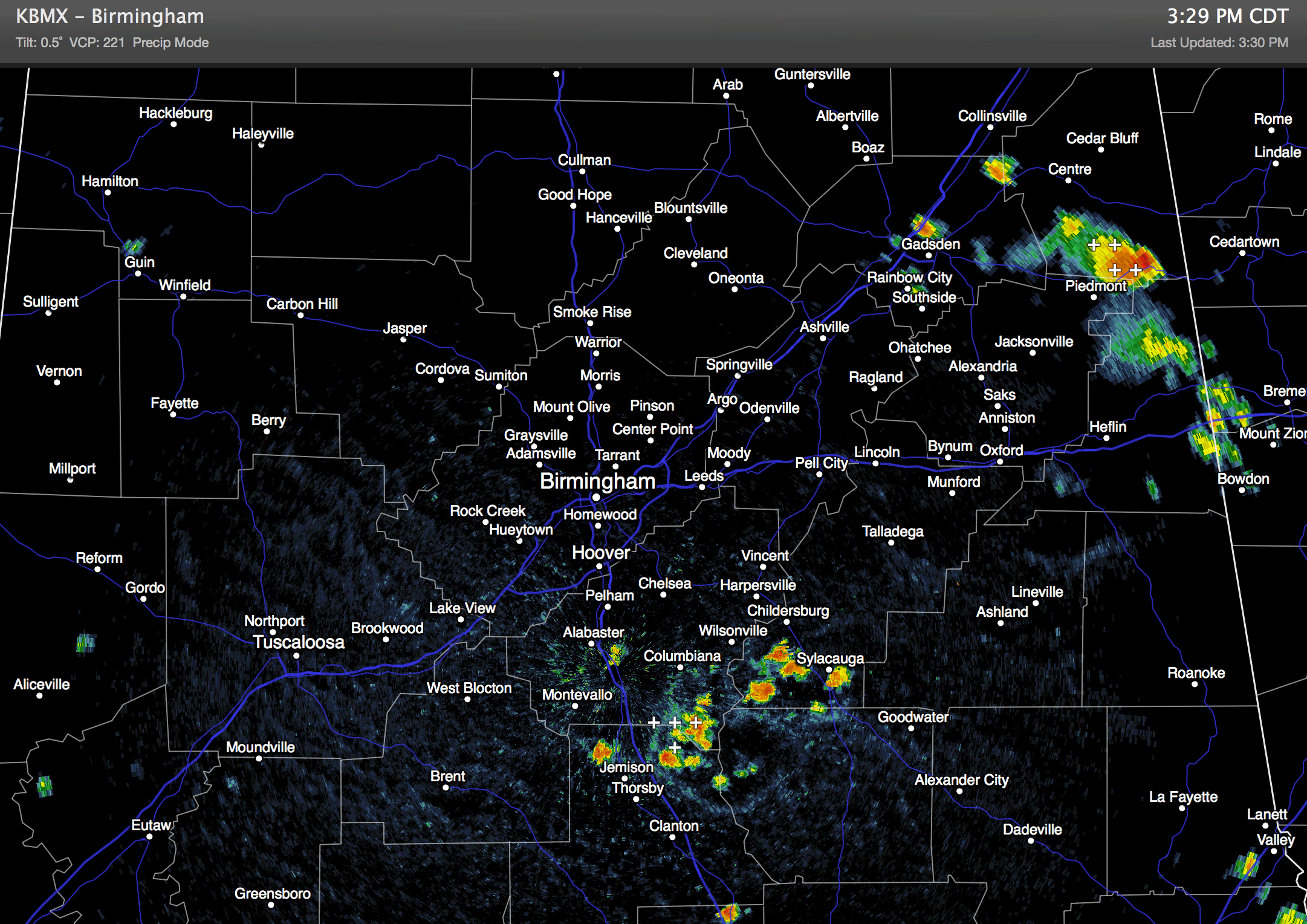
RADAR CHECK: While a large part of Alabama is rain-free today, a few strong storms have popped up over the central and eastern counties of the state. They are moving very slowly to the southeast…
Away from those storms, temperatures are mostly in the low to mid 90s with a mix of sun and clouds.
HOT THROUGH THE WEEKEND: Not much change in the overall thinking. An upper high will build across the Deep South, meaning afternoon highs tomorrow through Sunday will be generally in the mid to upper 90s. The National Weather Service in Birmingham has issued a “heat advisory” for their county warning area due to the heat and humidity. Partly sunny days, fair nights, and the risk of isolated thunderstorms each afternoon. The chance of any one spot specifically seeing a thunderstorm will be in the 10-20 percent range during the afternoon and evening hours.
FOOTBALL WEATHER: Not exactly the most comfortable time to start high school football in Alabama; we project kickoff temperatures in the 87 to 90 degree range tonight and tomorrow night, then falling through the 80s during the games, possibly reaching the upper 70s by the final whistle. The chance of any one stadium seeing a thunderstorm is about 15 percent both evenings.
NEXT WEEK: The upper ridge begins to break down, so expect heat levels to fall with scattered showers and storms becoming more numerous. Parts of North Alabama might not make it out of the 80s Monday and Tuesday. See the Weather Xtreme video for the maps, graphics, and details.
GULF COAST WEATHER: Looks great from Panama City to Gulf Shores through the weekend with mostly sunny days and fair nights; any thunderstorms will be very isolated. Highs on the immediate coast will be in the 87 to 91 degree range, with mid 90s inland.
TROPICS: The disturbance nearing the Leeward Islands still has some potential to become a tropical storm in coming days, but all tropical and global models turn this northward before reaching the Gulf of Mexico, and there is a high probability it will recurve into the Atlantic without threatening the U.S. mainland. Maps and graphics on the Weather Xtreme video.
WEATHER BRAINS: Don’t forget you can listen to our weekly 90 minute netcast anytime on the web, or on iTunes. This is the show all about weather featuring many familiar voices, including our meteorologists here at ABC 33/40.
CONNECT: You can find me on all of the major social networks…
Facebook
Twitter
Google Plus
Instagram
Look for the next Weather Xtreme video here by 7:00 a.m. tomorrow….
Category: Alabama's Weather
About the Author (Author Profile)
James Spann is one of the most recognized and trusted television meteorologists in the industry. He holds the AMS CCM designation and television seals from the AMS and NWA. He is a past winner of the Broadcast Meteorologist of the Year from both professional organizations.Subscribe
If you enjoyed this article, subscribe to receive more just like it.


