

Sun Dog Sunday
An upper level disturbance to the west of Alabama has spread a nice layer of cirrostratus clouds across the northern third of the state this afternoon. It has resulted in some beautiful sun dogs, an optical phenomenon caused by the refracting of sunlight through ice crystals.
Here is an example I captured on I-20 near Talladega:
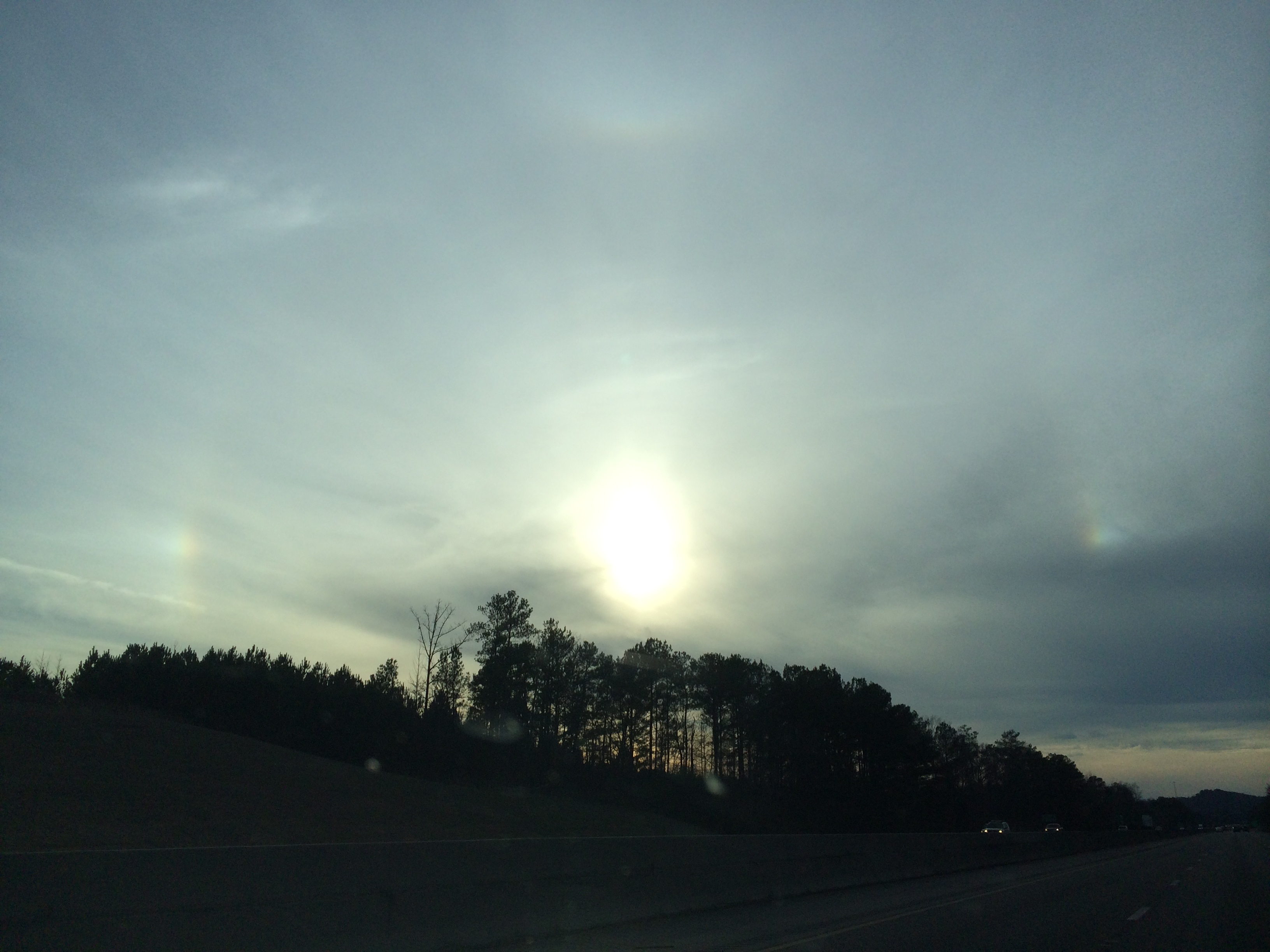
You can actually see both sides!
You can actually see a band of cirrocumulus over northern Mississippi extending into the Tennessee Valley caused by forcing ahead of the disturbance.
Temperatures are in the 50s. We will drop to near 40 overnight with mostly cloudy skies. Skies will become partly cloudy on Monday with highs in the 50s. Colder air will spread in behind the disturbance on Tuesday leading to below freezing overnight readings and highs in the 40s in spots Wednesday and Thursday. No rain expected next seven days.
Category: Alabama's Weather, Hodgepodge
About the Author (Author Profile)
Bill Murray is the President of The Weather Factory. He is the site's official weather historian and a weekend forecaster. He also anchors the site's severe weather coverage. Bill Murray is the proud holder of National Weather Association Digital Seal #0001 @wxhistorianSubscribe
If you enjoyed this article, subscribe to receive more just like it.


