

Rain At Times Through Tonight
An all new edition of the ABC 33/40 Weather Xtreme video is available in the player on the right sidebar of the blog. You can subscribe to the Weather Xtreme video on iTunes by clicking here.
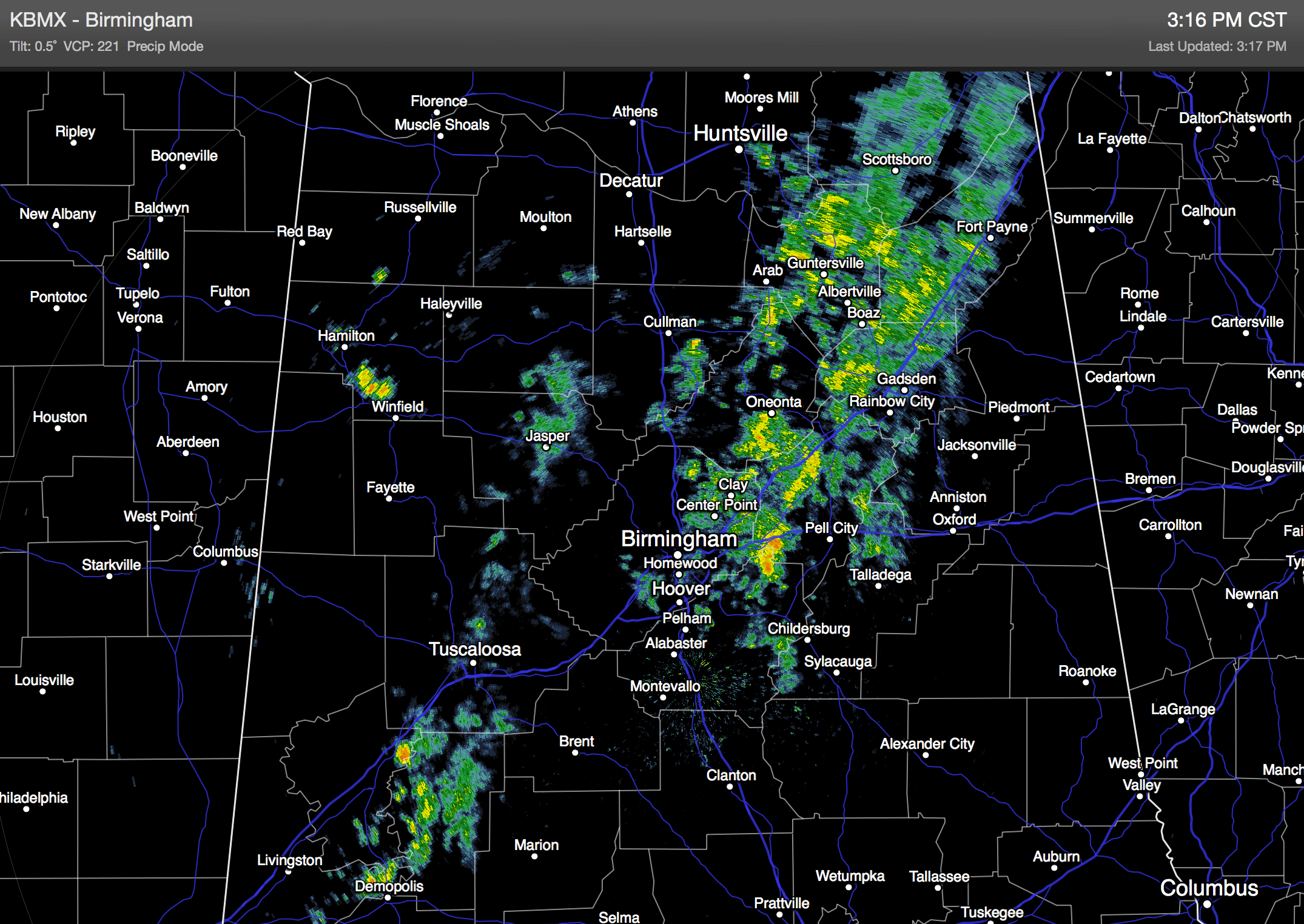
RADAR CHECK: Showers are little ahead of schedule this afternoon; much of Central and West Alabama are wet at mid-afternoon…
Occasional showers will continue tonight, ending after midnight in most places with rain amounts generally under 1/2 inch. Then, the sky will become partly sunny during the day tomorrow as drier air enters the state. We expect a high tomorrow in the mid to upper 50s, about average for mid-December in Alabama.
WEDNESDAY/THURSDAY: Wednesday will be dry with a mix of sun and clouds, and a high in the mid 50s. Clouds thicken Thursday as moist air begins to return, and we will mention just a chance of a shower Thursday afternoon; nothing especially widespread. The high Thursday afternoon will hold in the mid 50s.
WET WEATHER RETURNS AS THE WEEKEND BEGINS: A significant storm system in the southern branch of the jet stream will impact Alabama with rain, beginning at some point during the day Friday. The rain become more widespread Friday night, and should end during the day Saturday as a surface low moves away from the state. The forecast surface low track, right across Central Alabama, suggests there will be no risk of severe weather, although some thunder is certainly possible. Rain amounts should average one inch, with potential for more in a few spots, especially over Northwest Alabama.
Drier air returns Saturday night, and Sunday will be rain-free with a partly sunny and a high in the mid to upper 50s.
CHRISTMAS WEEK: A wave of low pressure is expected to form in the western Gulf of Mexico Sunday night; the 12Z GFS keeps the rain with this feature south of the Gulf Coast, over the Gulf. One way or another it should not impact North or Central Alabama, and at this point our weather looks dry Monday and Tuesday with seasonal temperatures; highs in the 50s and lows in the 30s.
An active southern branch of the jet stream is expected to set up later in the week, and a number of global model runs have suggested we might have some rain to deal with on Christmas Eve, Wednesday December 24, followed by a cold and dry Christmas Day. But, there is no way to resolve timing this far in advance. See the Weather Xtreme video for the maps, graphics, and more details.
It does look like colder weather will impact the Deep South over the final week of December.
WEATHER BRAINS: Don’t forget you can listen to our weekly 90 minute netcast anytime on the web, or on iTunes. This is the show all about weather featuring many familiar voices, including our meteorologists here at ABC 33/40. We will produce this week’s show tonight at 8:30 CT… you can watch it on “James Spann 24/7” on cable systems around the state, or on the web here.
CONNECT: You can find me on all of the major social networks…
Facebook
Twitter
Google Plus
Instagram
Look for the next Weather Xtreme video here by 7:00 a.m. tomorrow….
Category: Alabama's Weather
About the Author (Author Profile)
James Spann is one of the most recognized and trusted television meteorologists in the industry. He holds the AMS CCM designation and television seals from the AMS and NWA. He is a past winner of the Broadcast Meteorologist of the Year from both professional organizations.Subscribe
If you enjoyed this article, subscribe to receive more just like it.


