

Heavy Showers Developing, Strong to Severe Storms Tomorrow
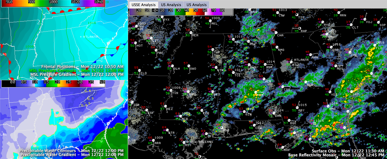
Heavy showers have developed early this afternoon across North and Central Alabama in a moistening atmosphere to the southeast of a disturbance over the Missouri Bootheel.
The moisture increase is in response to an increasing southeasterly flow between a surface high near Washington DC and a surface low near Dallas.
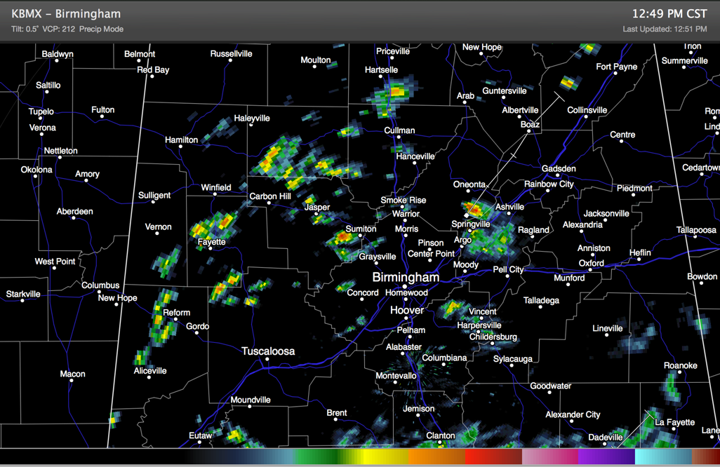
One of the showers over northeastern Jefferson County dumped some quick heavy rainfall that was of short duration. Only 0.09″ fell at the airport, but he heaviest rain fell between Clay and Springville. That shower is west of Springville now.
Other heavy showers were over parts of Fayette, Walker and Winston Counties. Some of these showers may manage to grow into storms over the next couple of hours and they could produce small hail. But severe weather is not expected across North Central Alabama this afternoon or tonight.
The Storm Prediction Center has a “marginal Risk”, just below their standard “slight risk” forecast in effect for today and tonight for areas south of a line from Demopolis to Greenville to Dothan.
A complex storm system will bring heavy showers and storms to Central Alabama tomorrow starting by late morning as a warm front lifts northward from the Gulf. Those storms will continue into the overnight hours and until after midnight ahead of a cold front. That front will arrive early Wednesday morning, putting an end to the rain and storms.
Tomorrow’s Day Two Outlook from the SPC now has a slight risk as far north as Tuscaloosa and Shelby Counties.
Category: Alabama's Weather, Severe Weather
About the Author (Author Profile)
Bill Murray is the President of The Weather Factory. He is the site's official weather historian and a weekend forecaster. He also anchors the site's severe weather coverage. Bill Murray is the proud holder of National Weather Association Digital Seal #0001 @wxhistorianSubscribe
If you enjoyed this article, subscribe to receive more just like it.


