

Strong Storms Possible Tomorrow Night
An all new edition of the ABC 33/40 Weather Xtreme video is available in the player on the right sidebar of the blog. You can subscribe to the Weather Xtreme video on iTunes by clicking here.
RADAR CHECK: Pretty nasty weather for Alabama today; cold and wet. Rain continues to fall, with temperatures only in the 40s from Birmingham north, and low 50s to the south. There have even been a few elevated thunderstorms in the cold air.
Periods of rain will continue tonight; temperatures will remain steady, or actually rise slowly during the night.
WARMER TOMORROW; STRONG STORMS: A surge of warmer air will move up from the south tomorrow, and we have a decent chance of reaching 70 degrees; quite the contrast to today’s cold weather. During the day, a few passing showers and storms are likely, but it won’t rain all day, and the sun might even break out briefly a few times.
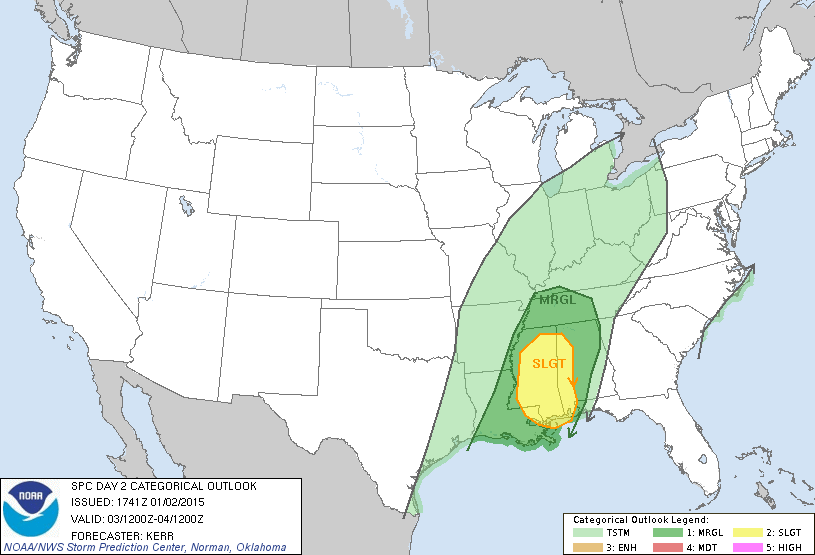
As the main dynamic support arrives late tomorrow and tomorrow night, and with moist, unstable air in place, the stage is set for the potential for strong to severe thunderstorms across Alabama. The guys at SPC (the Storm Prediction Center) have expanded the standard “slight risk” of severe weather; it now includes much of West Alabama, generally along and west of U.S. 43. The rest of North and Central Alabama is in a “marginal risk”, which is a lower end threat.
TIMING: The main window for strong to severe storms will come from roughly 2:00 p.m. tomorrow through 1:00 a.m. Sunday.
MODES: Storms tomorrow night could produce hail and strong, possibly damaging winds. An isolated tornado is also possible. Keep in mind the primary threat of severe storms is over the western third of Alabama, with a lower risk to the east.
RAIN TOTALS: Storm totals of 2 inches are likely, with some spots possibly getting over three inches of rain by early Sunday. Some localized flooding issues are possible.
BIRMINGHAM BOWL: It will be a very comfortable day for the Florida/East Carolina game at Legion Field (the game kicks off at 11:00a CT). A few passing showers are possible during the game, and a thunderstorm is not out of the question. But, on the positive side, the sun could break out at times, and temperatures will rise from the low 60s at kickoff, to near 70 degrees by the fourth quarter.
SUNDAY: The rain ends Sunday morning, and colder air moves into the state with lingering clouds. Temperatures will hold in the 50s during the day Sunday, and the sky should clear Sunday night with upper 20s likely by daybreak Monday.
ARCTIC AIR NEXT WEEK: Monday will be mostly sunny with a high in the 40s, but the coldest air blows in here Wednesday with a stiff north wind. The 12Z GFS is printing a low of 17 degrees for Birmingham at daybreak Thursday, followed by a high only in the upper 30s Thursday afternoon. Another hard freeze is likely early Friday morning, followed by a warming trend. The air will be dry, and no wintry precipitation is expected during the short lived cold wave.
See the Weather Xtreme video for maps, graphics, and more details.
WEATHER BRAINS: Don’t forget you can listen to our weekly 90 minute netcast anytime on the web, or on iTunes. This is the show all about weather featuring many familiar voices, including our meteorologists here at ABC 33/40.
CONNECT: You can find me on all of the major social networks…
Facebook
Twitter
Google Plus
Instagram
Look for my next Weather Xtreme video by Monday morning at 7:00 a.m…. Brian Peters will have the video updates here tomorrow and Sunday. Enjoy the weekend!
Category: Alabama's Weather
About the Author (Author Profile)
James Spann is one of the most recognized and trusted television meteorologists in the industry. He holds the AMS CCM designation and television seals from the AMS and NWA. He is a past winner of the Broadcast Meteorologist of the Year from both professional organizations.Subscribe
If you enjoyed this article, subscribe to receive more just like it.


