

Eyes On Radar Trends
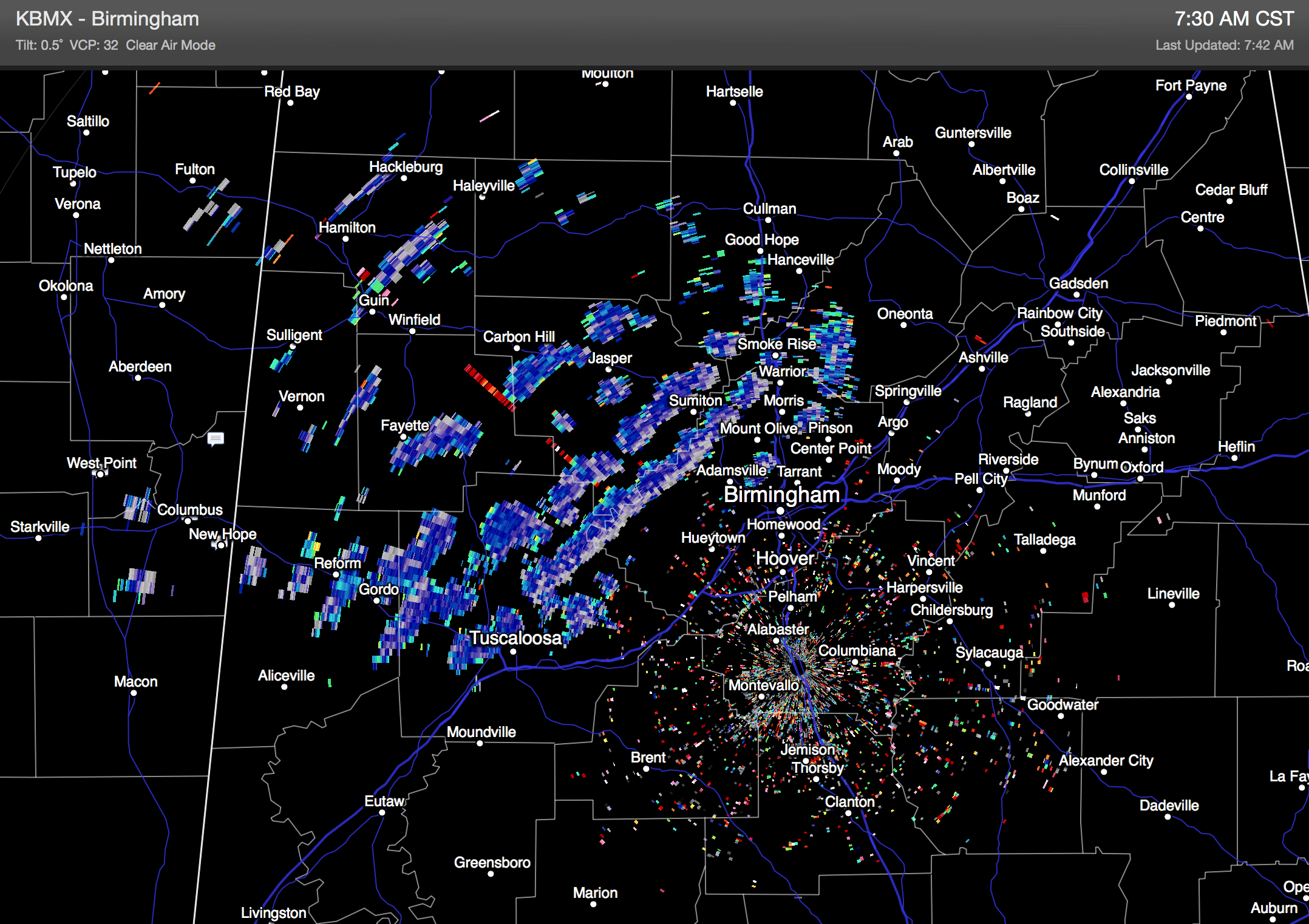
Light snow/sleet/graupel is seen on dual pol radar this morning over parts of Central and West Alabama…
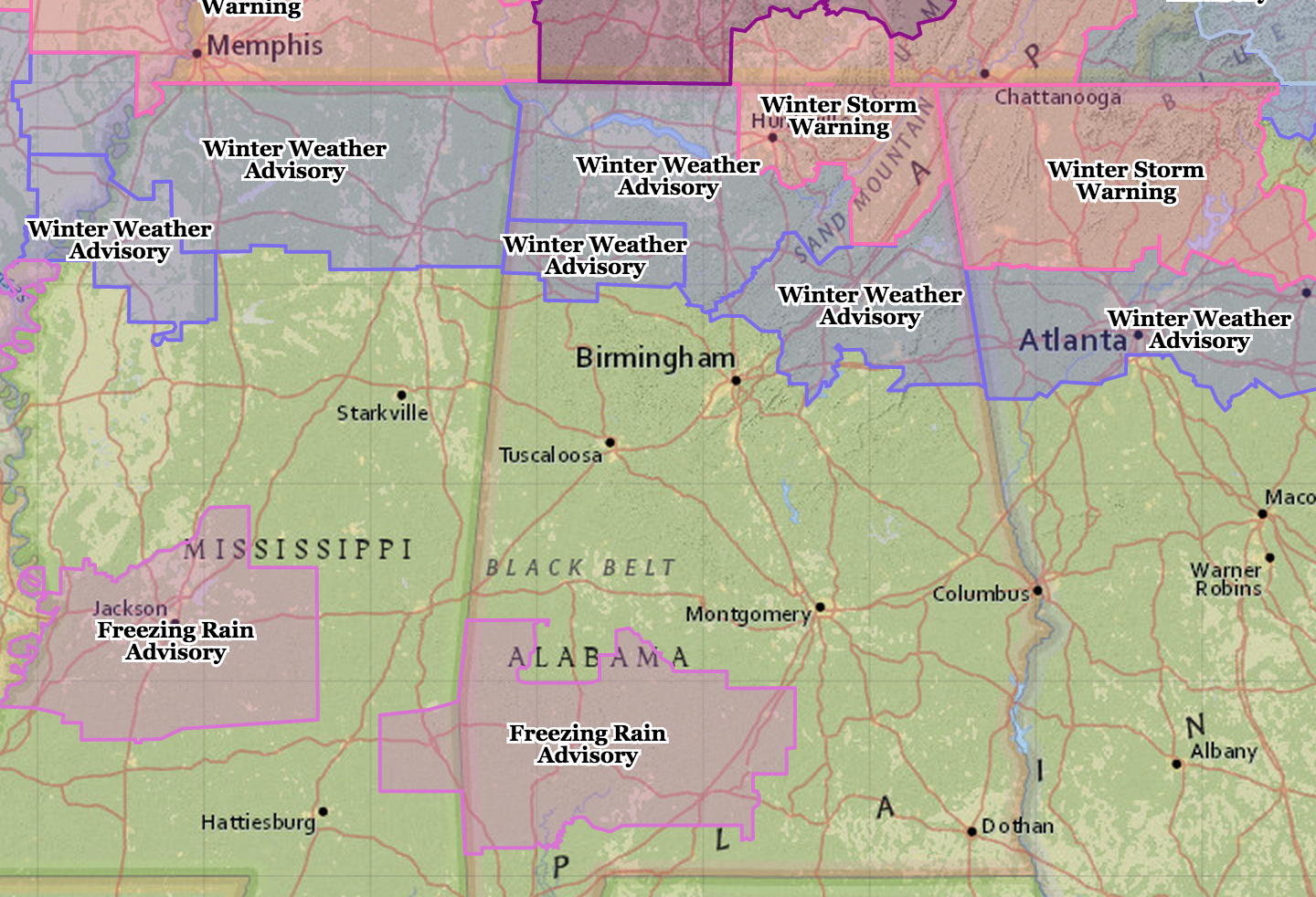
We also note freezing rain over parts of South Mississippi; NWS offices in Jackson and Mobile have issued freezing rain advisories for some of their counties due to icing on bridges and some roads.
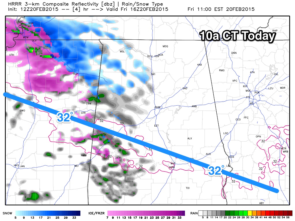
Here is a look at the HRRR model, valid at 10:00 a.m.
Light wintry precipitation (sleet/snow/graupel/freezing rain) will be moving through parts of the state with sub-freezing temperatures… we will need to watch radar trends and surface reports closely since things seem to be unfolding a little quicker, and farther south than expected.
ALABAMA POWER IS READY, ARE YOU? Our friends at Alabama Power are monitoring the forecast closely, ready to deploy people and assets to quickly address any outages that might occur. Read a special message from Ike Piggot about their commitment to their customers.
Stay tuned for updates through the morning…
Category: Alabama's Weather
About the Author (Author Profile)
James Spann is one of the most recognized and trusted television meteorologists in the industry. He holds the AMS CCM designation and television seals from the AMS and NWA. He is a past winner of the Broadcast Meteorologist of the Year from both professional organizations.Subscribe
If you enjoyed this article, subscribe to receive more just like it.


