

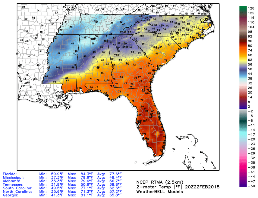
Wide Disparity in Temperatures
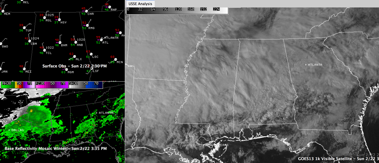
Clouds are thick across Central Alabama this afternoon. You can see the precipitation over Arkansas and northern Texas ahead of the next disturbance that will bring a potential wintry mix to North and North Central Alabama late tonight and early Monday.
There is a wide disparity in temperatures across the state, ranging from the upper 30s over Northwest Alabama to the upper 40s in the I-59 corridor to near 70F at Montgomery.
Afternoon model data is pretty much on track and consistent, showing some scattered pockets of freezing rain embedded in a precipitation shield that will move across Alabama late tonight and early Monday. NO change in advisories or our official forecast. Scroll down for further details.
ALABAMA POWER IS READY, ARE YOU? Our friends at Alabama Power are monitoring the forecast closely, ready to deploy people and assets to quickly address any outages that might occur. Read a special message from Ike Piggot about their commitment to their customers.
Category: Alabama's Weather, Winter Weather
About the Author (Author Profile)
Bill Murray is the President of The Weather Factory. He is the site's official weather historian and a weekend forecaster. He also anchors the site's severe weather coverage. Bill Murray is the proud holder of National Weather Association Digital Seal #0001 @wxhistorianSubscribe
If you enjoyed this article, subscribe to receive more just like it.


