Sunday Night Look
We continue to watch radar/temperature trends tonight. One of our better performing high resolution, short term models is the HRRR, and it is suggesting the freeze line will be north of Birmingham/Tuscaloosa/Anniston/Gadsden early tomorrow morning…
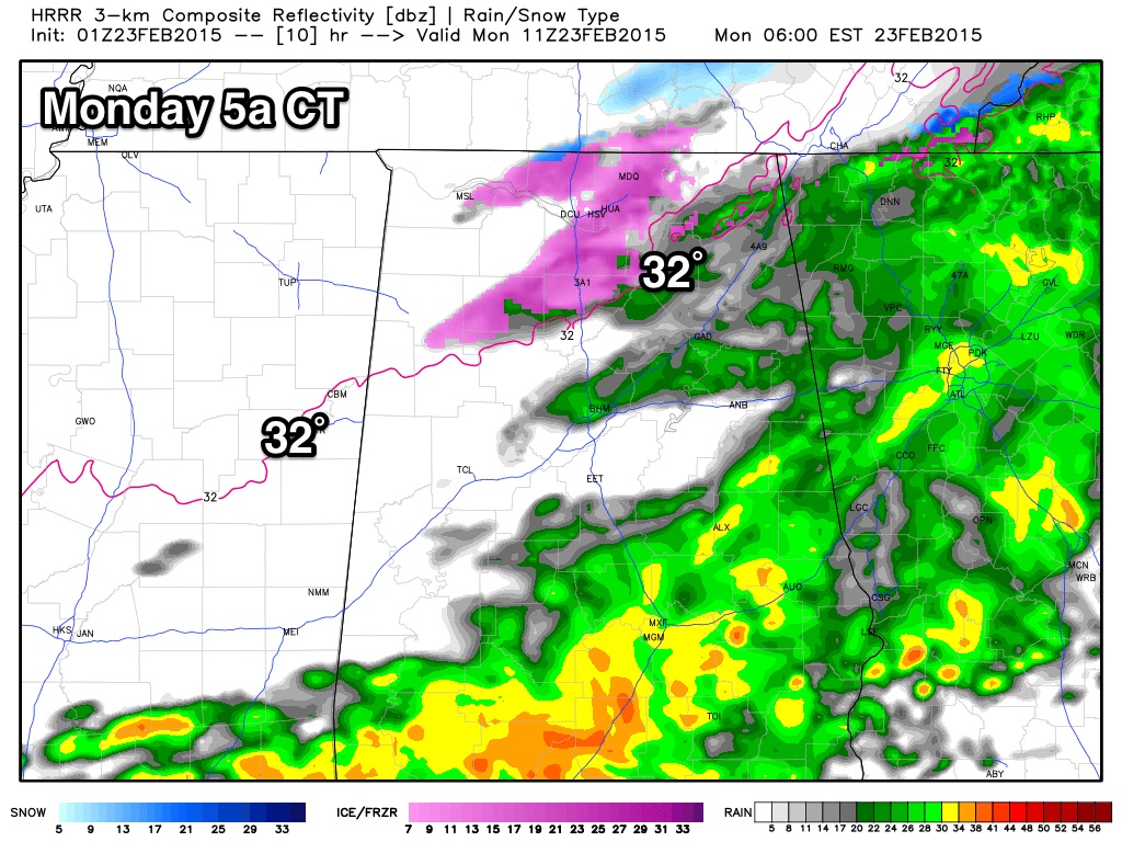
If this is indeed the case, most of the freezing rain issues will be north of U.S. 278 (north of a line from Hamilton to Cullman to Gadsden). However, even good, high resolution models often can be poor at thermal fields in a very shallow, cold airmass, so those down to I-59 still need to be ready for ice travel early tomorrow.
To the north, Nashville is getting close to freezing, and the 32 degree line should slip into North Alabama after midnight…
It is going to be the classic timing issue with cold air coming in from the north, as the deeper moisture begins to lift out early tomorrow morning.
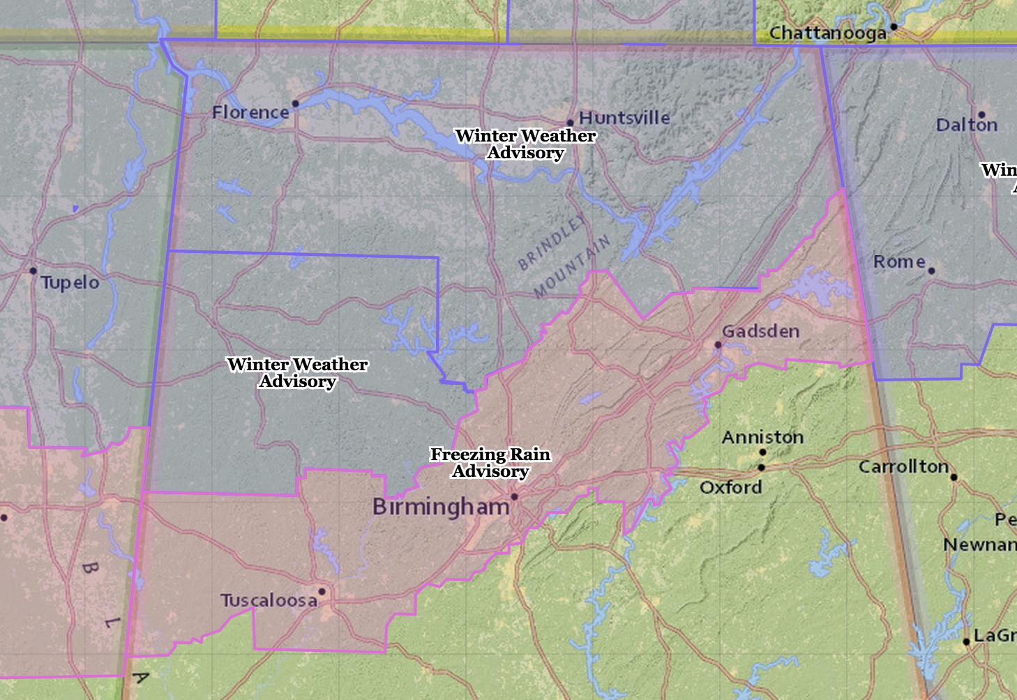
NWS advisories have not changed.
BOTTOM LINE: Since icy travel is still possible down to I-59 (Tuscaloosa to Birmingham to Gadsden) early tomorrow, but the higher probability of travel impact is a bit to the north. Get up extra early tomorrow and check on road conditions before you head out. I will have a full discussion and a new Weather Xtreme video posted early tomorrow.
ALABAMA POWER IS READY, ARE YOU? Our friends at Alabama Power are monitoring the forecast closely, ready to deploy people and assets to quickly address any outages that might occur. Read a special message from Ike Piggot about their commitment to their customers.
Category: Alabama's Weather
About the Author (Author Profile)
James Spann is one of the most recognized and trusted television meteorologists in the industry. He holds the AMS CCM designation and television seals from the AMS and NWA. He is a past winner of the Broadcast Meteorologist of the Year from both professional organizations.Subscribe
If you enjoyed this article, subscribe to receive more just like it.


