

Late Morning Update
Understand we have TWO winter weather issues ahead… one tonight and tomorrow morning, and another on Wednesday. Both will have an impact…
TONIGHT/TOMORROW MORNING:
A band of precipitation will move into Alabama tonight. Cold air is now in place…
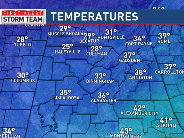
Initially, freezing rain and maybe some light snow will bring the risk of icy travel to areas north of a line from Reform to Gardendale to Gadsden this evening. Travel issues could begin in this zone as early as 6:00 p.m.
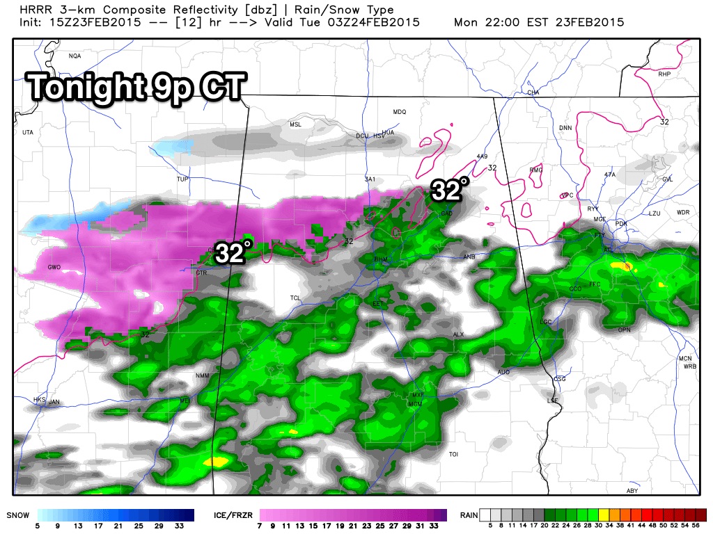
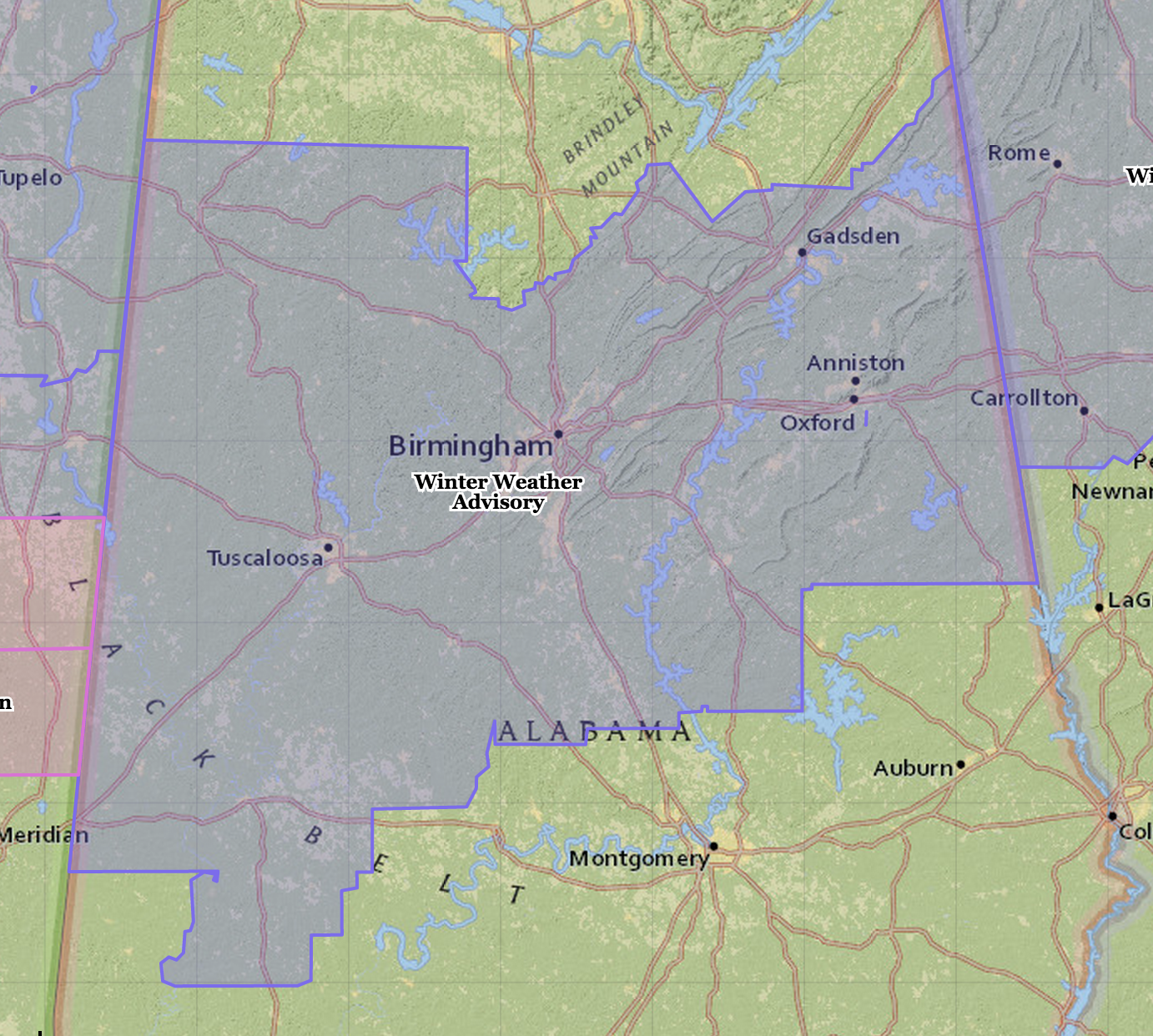
The freeze line will drop south during the night, and by daybreak tomorrow it will be along a line from Livingston to Calera to Wedowee. This means light freezing rain and drizzle overnight could bring icy travel to the larger cities of Birmingham, Tuscaloosa, Anniston, and Gadsden. A new winter weather advisory has been issued for much of north and central Alabama for this event by the National Weather Service in Birmingham.
Temperatures rise above freezing by 10:00 a.m. tomorrow and icy travel issues will fade.
WEDNESDAY:
Morning model runs continue to show a significant snow event for North/Central Alabama. The NAM is the most aggressive short term model… below is potential accumulation from the NAM model. NOT a forecast, just model output.
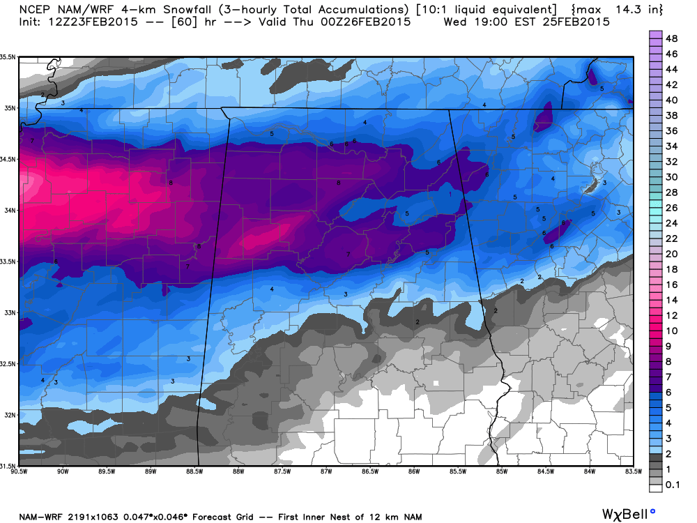
This model is putting down 4-8 inches of snow around here, which seems too aggressive, but certainly not impossible. Using a more sensible ensemble approach, a 2-3 inch snow forecast looks more reasonable for now.
With classic Gulf low systems like this, there will be a strip of heavier snow, usually 30-40 miles wide, and there is no to determine where this happens now.
Concerning timing, it looks like the snow will begin sometime between 6:00 and 10:00 a.m. Wednesday, then continuing through the day.
This could be a high impact event; I will have deeper details on the afternoon discussion.
REMEMBER: The forecast for tonight’s event, and the event Thursday, can, and probably will change. Check the blog often for updates so you won’t be working with old information!
Category: Alabama's Weather
About the Author (Author Profile)
James Spann is one of the most recognized and trusted television meteorologists in the industry. He holds the AMS CCM designation and television seals from the AMS and NWA. He is a past winner of the Broadcast Meteorologist of the Year from both professional organizations.Subscribe
If you enjoyed this article, subscribe to receive more just like it.


