

Late Morning Update
The 12Z run of the GFS model is in….
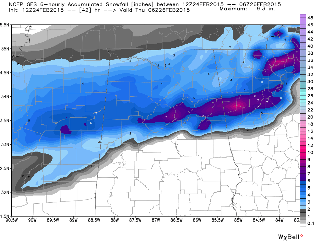
I think the 7″ number printed at Birmingham is too aggressive, but not impossible. Someone will probably see 8″ on the high end in a few places, but the strip of heavier snow, most likely will be north of Birmingham. But understand nobody knows at this point where the narrow strip of heavy snow will set up.
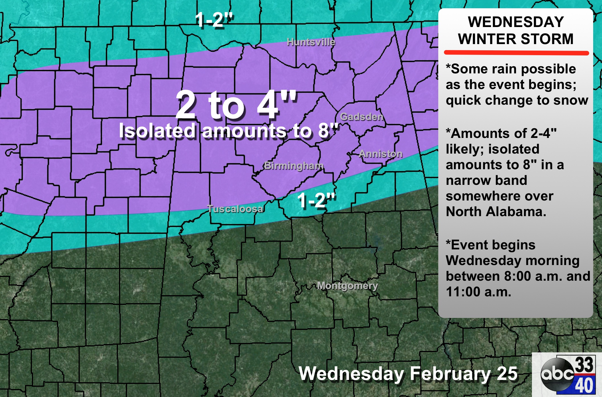
This is our updated public forecast…
There is going to be a sharp cutoff to the snow just south of I-20… the magical “rain-snow” line. That is the most difficult part of the forecast. Could be a situation where Gardendale gets 4 inches of snow, and Calera gets a cold, rainy day. That line will be, most likely, adjusted again later today and tonight, so keep checking for updates.
Scroll down for the post below this one for timing, impact, etc…
ALABAMA POWER IS READY, ARE YOU? Our friends at Alabama Power are monitoring the forecast closely, ready to deploy people and assets to quickly address any outages that might occur. Read a special message from Ike Pigott about their commitment to their customers.
Category: Alabama's Weather
About the Author (Author Profile)
James Spann is one of the most recognized and trusted television meteorologists in the industry. He holds the AMS CCM designation and television seals from the AMS and NWA. He is a past winner of the Broadcast Meteorologist of the Year from both professional organizations.Subscribe
If you enjoyed this article, subscribe to receive more just like it.


