

Midday Look
After a review of the 12Z model data set, here is our public forecast for the event tomorrow.
The 75th percentile snow potential forecast from the Weather Prediction Center (a branch of the NWS), is a bit more aggressive…
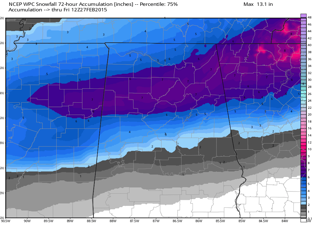
The 75th percentile output has verified nicely in recent weather events, but that is just guidance. Our forecast remains the same.
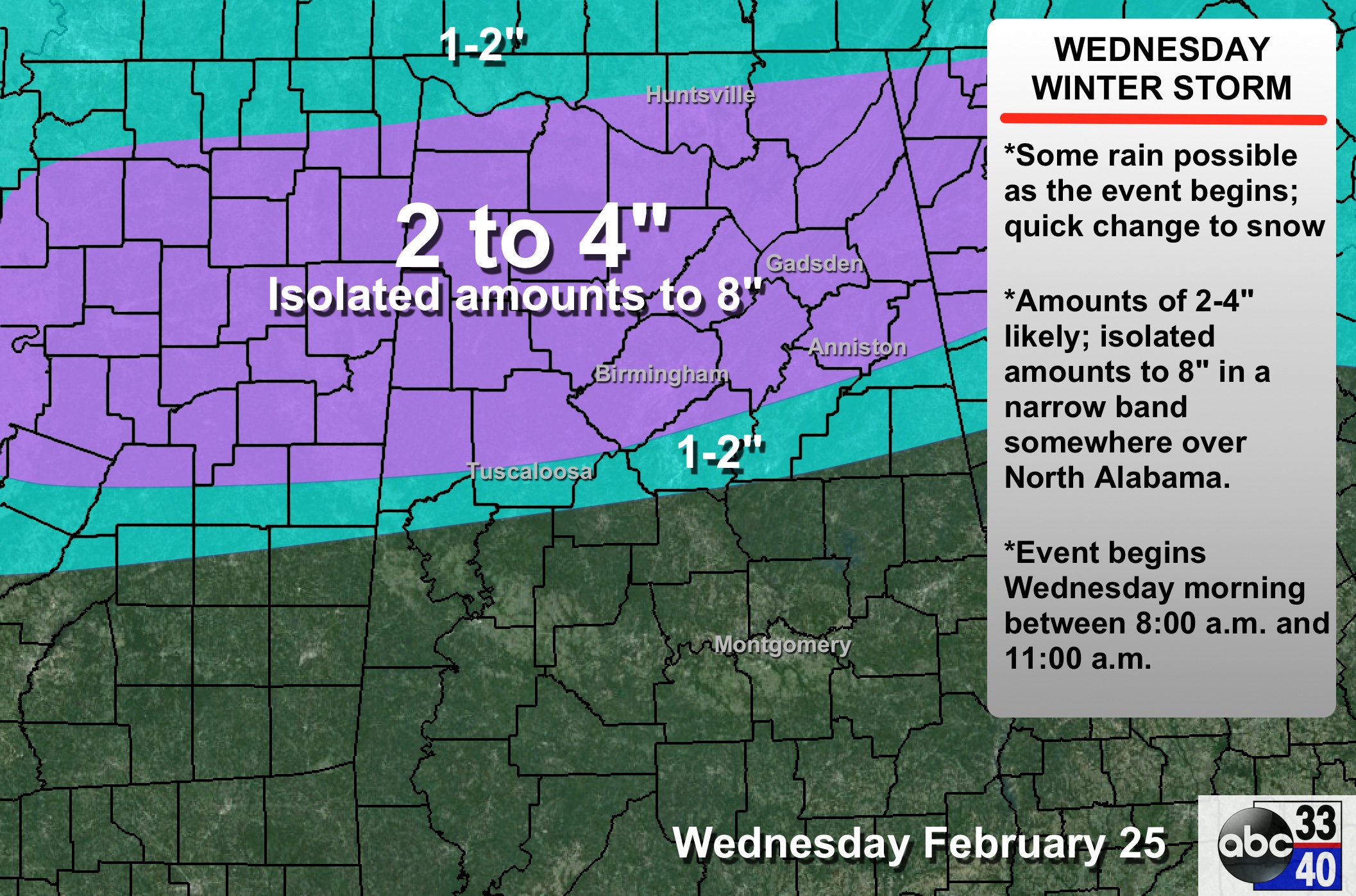
TIMING: Precipitation will begin between 8:00 and 11:00 a.m. Heaviest snow will come from 12:00 noon to 6:00 p.m.. then it all winds down tomorrow night. The precipitation will move into Alabama from the west, and will progress eastward during the late morning and midday hours.
PRECIPITATION TYPE: Remember, this could begin with rain, but dynamic cooling will bring a quick change to snow, mainly north of a line from Moundville to Calera to Wedowee. Rain will fall south of that line.
ACCUMULATION POTENTIAL: Average amounts of 2-4 inches are likely across North/Central Alabama, with potential to 8 inches in isolated spots in a heavier snow band that will set up somewhere over the northern counties of the state. We don’t know where that will be now.
IMPACT: In the heaviest snow band, there could be enough heavy, wet snow for some scattered power outages. Travel will also be severely impacted where the heaviest snow falls. Travel issues will most likely linger into Thursday morning; temperatures climb above freezing by mid-morning Thursday with conditions should begin to improve on roads.
CONFIDENCE: The confidence level in the event is very high. Biggest challenge is forecasting placement of the rain/snow line. Again, for now, we believe the line will be roughly from Moundville to Calera to Wedowee. This will probably change as we get closer to the event.
WARNINGS ISSUED SHORTLY: Winter storm warnings will be issued soon by NWS offices in Huntsville and Birmingham. A winter weather advisory will be issued for those in the 1-2″ zone.
IMPORTANT: We all know winter storms don’t follow the nice clean lines we draw on maps. Some will be delighted with the amount of snow they received, others will be severely disappointed. Just the way it is.
AND… please check the blog for forecast changes later today and tonight. If this is the last forecast you see before tomorrow, you will be using outdated information tonight.
ALABAMA POWER IS READY, ARE YOU? Our friends at Alabama Power are monitoring the forecast closely, ready to deploy people and assets to quickly address any outages that might occur. Read a special message from Ike Pigott about their commitment to their customers.
More later…
Category: Alabama's Weather
About the Author (Author Profile)
James Spann is one of the most recognized and trusted television meteorologists in the industry. He holds the AMS CCM designation and television seals from the AMS and NWA. He is a past winner of the Broadcast Meteorologist of the Year from both professional organizations.Subscribe
If you enjoyed this article, subscribe to receive more just like it.


