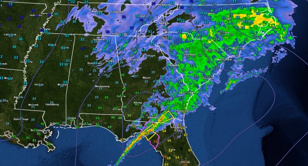
Event Winding Down
Snow is limited to the northeastern quarter of Alabama at this hour, but it has been a historic storm for North Alabama.
A 1004 mb surface low moving across the northern Gulf of Mexico was the culprit. The bullseye was generally along the US-278 corridor south of the Tennessee River in North Alabama. A foot of snow fell across parts of Marion and Winston Counties, including 12” at Natural Bridge and 11” at Guin, Hamilton and Haleyville. Six inches or more of snow fell across a wide area from Etowah and Cherokee Counties on the east to Walker and Marion counties on the west.
The Huntsville International Airport picked up over 8 inches of snow from this event, making it the 4th biggest single storm event there and the third biggest single day total. It was the second biggest single day snow of record at Hamilton if the 11 inch total stands up there. At Haleyville, it is the fourth biggest single day snow.
Roads are hazardous tonight across a wide area where significant snow has fallen.
Areas from Lamar down into Pickens Counties across the areas from Decatur to northern Jefferson County and on Gadsden and Anniston on the east, travel is not recommended tonight. Check conditions carefully before attempting to head out in the morning.
Category: Alabama's Weather


