

Afternoon Look At Mid-Week
Unfortunately morning model data still supports the POTENTIAL for a high impact winter storm across Alabama Wednesday night and Thursday.
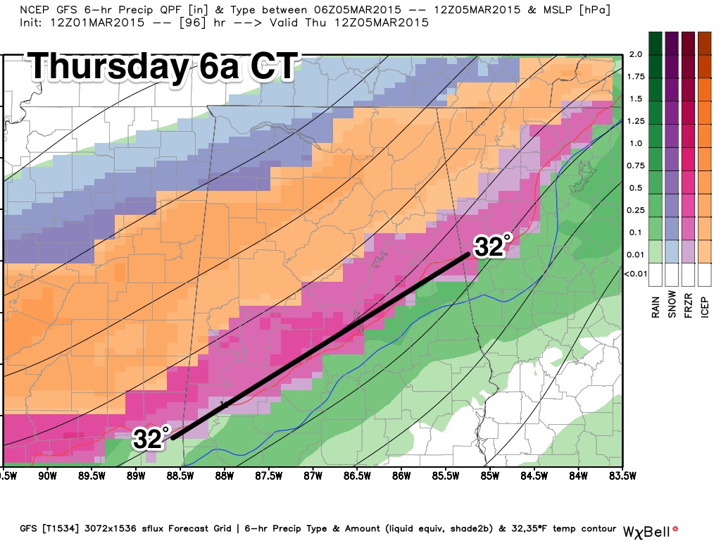
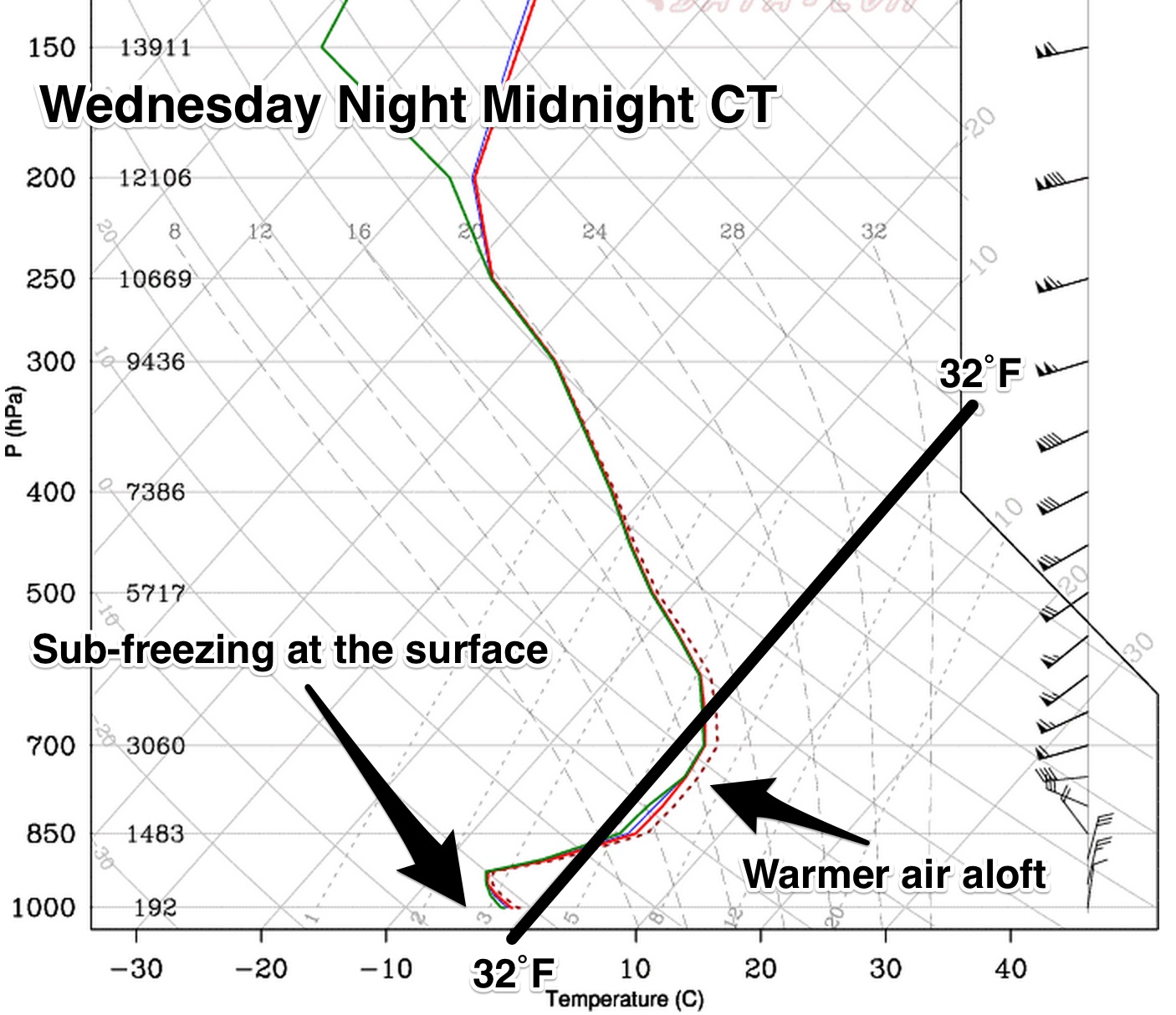
The GFS and ECMWF (Euro) remain in good agreement that temperatures will fall during the day Wednesday, and post-frontal precipitation will develop Wednesday night and Thursday in the cold air. Due to warmer air in the 5,000-10,000 foot region, much of this will fall in the form of freezing rain.
New data suggests that .25 to .50″ of freezing rain will fall at Birmingham…
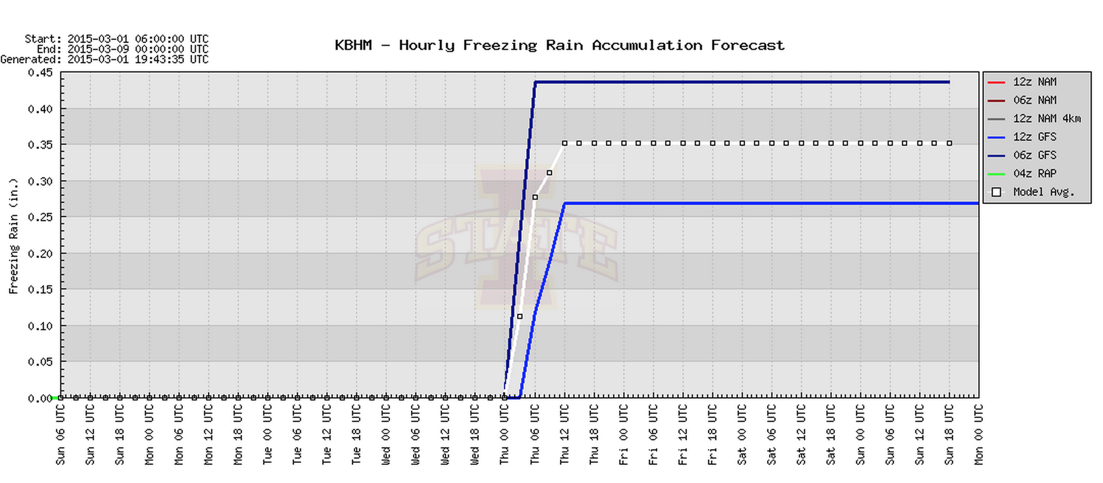
Should this verify, this could lead to a very significant ice accumulation, dangerous (if not impossible) travel conditions, and major power outages due to falling trees and power lines (due to the weight of the ice and winds of 10-20 mph).
Greatest risk of freezing rain and ice accumulation will be north of a line from Livingston to Clanton to Roanoke.
The primary timing of the freezing rain will come from about 6:00 p.m. Wednesday through 12:00 noon Thursday. It is likely the precipitation will change to snow as it ends.
UNDERSTAND: This is still several days away, and this forecast can change dramatically; we could wind up with a cold rain and just a little light snow. But, confidence is increasing, and you might consider planning now for yet another winter weather event this week. We will keep you posted….
Category: Alabama's Weather
About the Author (Author Profile)
James Spann is one of the most recognized and trusted television meteorologists in the industry. He holds the AMS CCM designation and television seals from the AMS and NWA. He is a past winner of the Broadcast Meteorologist of the Year from both professional organizations.Subscribe
If you enjoyed this article, subscribe to receive more just like it.


