

Continuing to Watch the Thermometer
Another surge of colder air seems to be pushing into West Alabama at this hour.
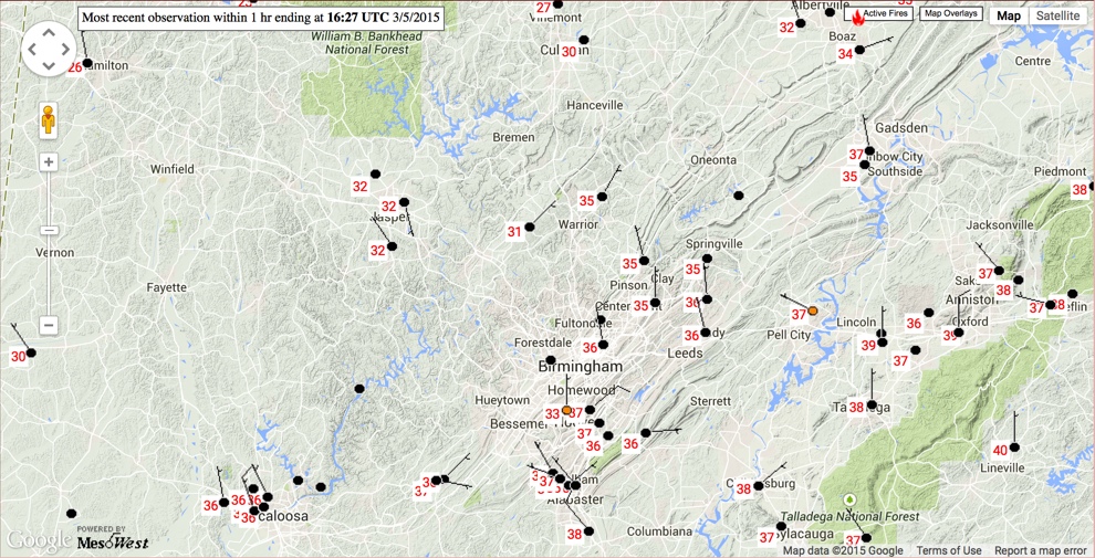
Temperatures have dropped to near freezing in the Jasper area in Walker County.
It is still 37F at Tuscaloosa Regional, but the precipitation has changed to freezing rain at Coal Fire in Pickens County according to the NWS. It is 30F at Millport in southern Lamar County.
Right now, roads are still ok in the Birmingham Metro area, but there is still another wave of precipitation over Central Mississippi from Natchez to Jackson to Philadelphia to Macon. There are numerous accidents in Hinds County MS on the west side of Jackson. It is 29F at Jackson now.
We still expect the colder air to move in before the precipitation ends in the I-59 corridor from Tuscaloosa to Birmingham to Gadsden. But it is an uncomfortable waiting game for now.
Tonight will be very cold across the area, with teens over northwestern and northern sections, readings near 20F in the I-59 corridor and lower 20s to the south and southeast.
Category: Alabama's Weather, Winter Weather
About the Author (Author Profile)
Bill Murray is the President of The Weather Factory. He is the site's official weather historian and a weekend forecaster. He also anchors the site's severe weather coverage. Bill Murray is the proud holder of National Weather Association Digital Seal #0001 @wxhistorianSubscribe
If you enjoyed this article, subscribe to receive more just like it.


