

Showers Tonight; Colder Tomorrow
An all new edition of the ABC 33/40 Weather Xtreme video is available in the player on the right sidebar of the blog. You can subscribe to the Weather Xtreme video on iTunes by clicking here.
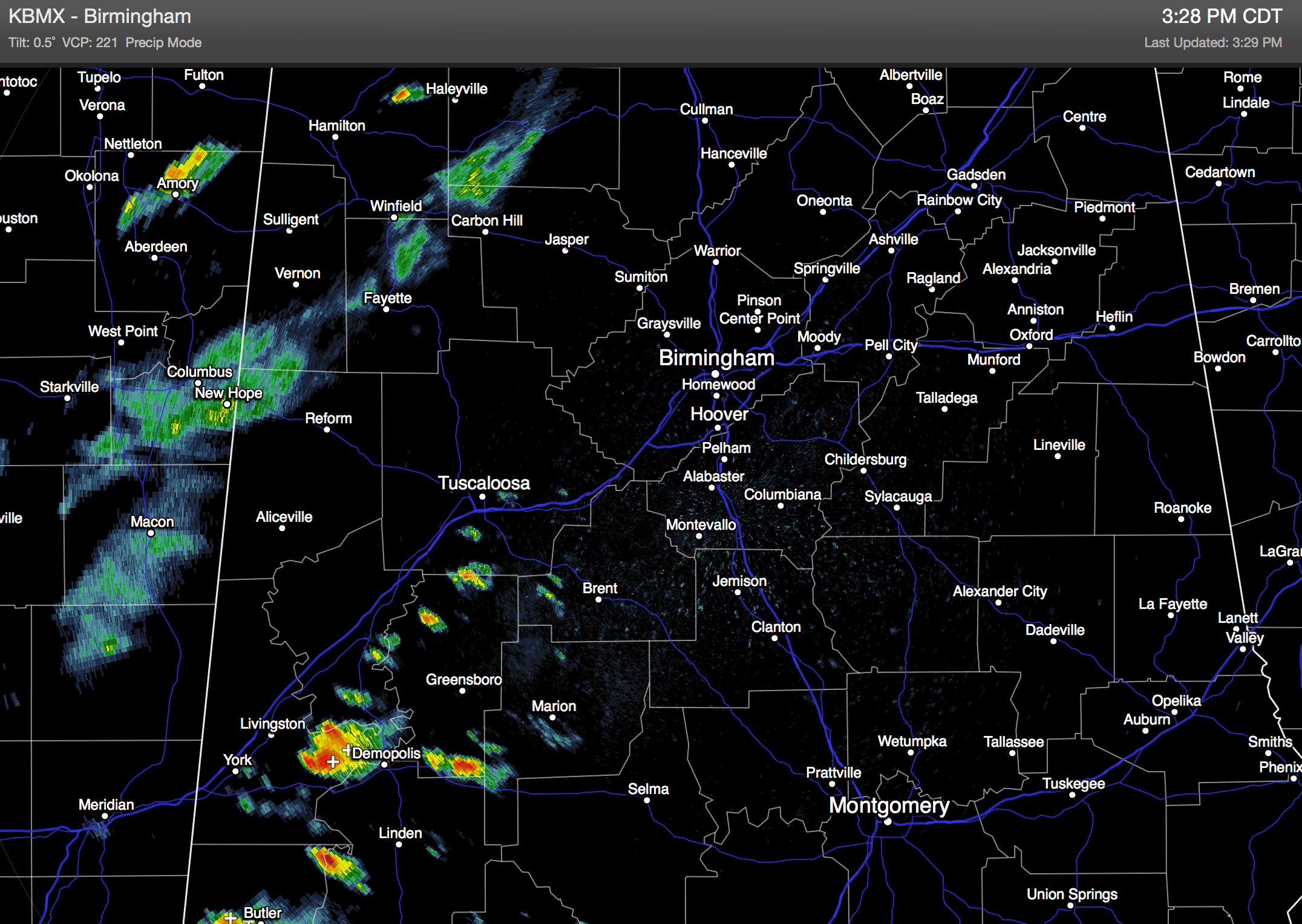
RADAR CHECK: Still not much happening on radar this afternoon; we do note a strong thunderstorm near Demopolis, and a band of showers over Northwest Alabama. Temperatures are mostly in the 70s with a mostly cloudy sky. A cold front is moving into the northwest corner of Alabama; behind the front temperatures are barely out of the 40s at Memphis and Nashville.
Showers and a few thunderstorms are likely this evening, but rain amounts won’t be especially heavy, and there is no really significant threat of severe weather. We do note SPC has a “marginal” severe weather risk up for parts of Central and Southwest Alabama for potential for a few strong wind gusts. Showers will end soon after midnight.
COLDER TOMORROW: A chilly north wind of 12-22 mph will usher in some pretty chilly air for late March tomorrow; the sky will be partly sunny with a high in the mid 50s.
FREEZE POTENTIAL: We have potential for a late season freeze across North/Central Alabama both Saturday and Sunday morning. The 12Z run of the GFS is printing a low of 31 degrees for Birmingham early Saturday, and 32 degrees early Sunday. Most places will see a low between 30 and 35 degrees, with potential for 20s in the colder valleys. Growers beware.
Saturday looks mostly dry; we will hang on to a slight risk of a little light rain Saturday afternoon with an impulse coming down the back side of the upper trough over the eastern U.S… but dewpoints will be very low, and it sure looks like most communities won’t have enough rain to measure. Saturday will remain very cool with a high between 50 and 55 degrees.
A warming trend begins Sunday afternoon with a high in the mid 60s along with a good supply of sunshine.
NEXT WEEK: Moist air returns Monday, and a few scattered showers are possible. We will have to maintain a chance of showers Tuesday; we project a high in the upper 60s Monday and low 70s Tuesday as the warming trend continues.
The GFS is backing off on the intensity of the mid-week system; showers and storms are likely late Wednesday into Thursday, but dynamic support looks less impressive at this point. But, understand we are still a week away from this event and things could change. See the Weather Xtreme video for maps, graphics, and more details.
GULF COAST WEATHER: After showers and storms tonight, expect clearing and cooler weather on the coast tomorrow from Panama City west to Gulf Shores with a high in the mid 60s. The weekend will feature a good supply of sunshine Saturday and Sunday with highs in the 60s and lows in the 40s… a few scattered showers are possible early next week, but still expect about 4 to 6 hours of sunshine Monday through Wednesday. Temperatures will be close to 70 degrees on those three afternoons. The sea water temperature at the Dauphin Island Sea Lab this afternoon is 67 degrees.
WEATHER BRAINS: Don’t forget you can listen to our weekly 90 minute netcast anytime on the web, or on iTunes. This is the show all about weather featuring many familiar voices, including our meteorologists here at ABC 33/40.
CONNECT: You can find me on all of the major social networks…
Facebook
Twitter
Google Plus
Instagram
I had a great time today visiting with the 3rd graders at Paine Intermediate School in Trussville… be looking for them on the Pepsi KIDCAM today at 5:00 on ABC 33/40 News! The next Weather Xtreme video will be posted here by 7:00 a.m. tomorrow…
Category: Alabama's Weather
About the Author (Author Profile)
James Spann is one of the most recognized and trusted television meteorologists in the industry. He holds the AMS CCM designation and television seals from the AMS and NWA. He is a past winner of the Broadcast Meteorologist of the Year from both professional organizations.Subscribe
If you enjoyed this article, subscribe to receive more just like it.


