

A Calmer Weather Day
An all new edition of the ABC 33/40 Weather Xtreme video is available in the player on the right sidebar of the blog. You can subscribe to the Weather Xtreme video on iTunes by clicking here.
AT DAYBREAK: Some lingering light rain over Lee County around Opelika is moving into Georgia, and the rest of the state is dry as the day begins following a day of hail producing thunderstorms. See hundreds of hail images on my Google Plus photo library here.
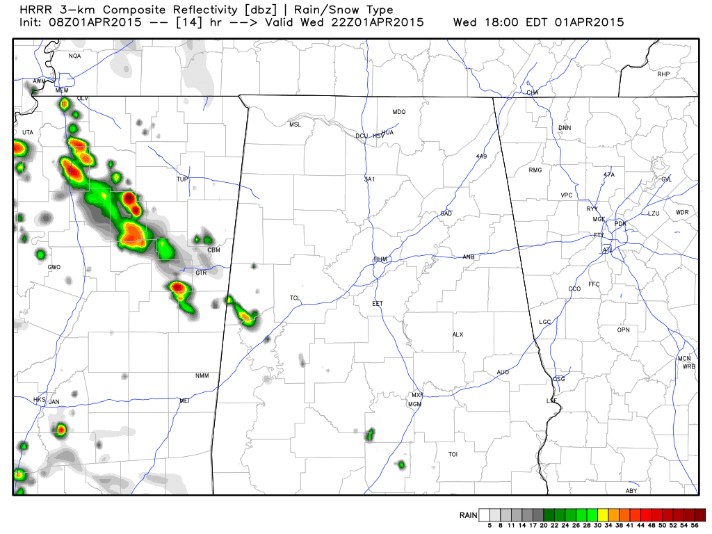
Today will be partly sunny and warm with high in the 77-81 degree range. An afternoon shower or storm can’t be ruled out, and where storms do happen to form they could be strong (SPC has a “marginal” severe weather risk up for most of the state), but there is little in the way of dynamic forcing, and storms should be few and far between. The HRRR shows very little activity across the state late this afternoon (this map is valid at 5pm CT)…
TOMORROW: Not much change; perhaps a little better coverage of showers and storms, but they will remain pretty scattered, and a decent part of the day will be dry. The high tomorrow will be close to 80 degrees.
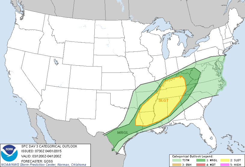
FRIDAY NIGHT COLD FRONT: An approaching surface front will bring an organized band of showers and storms into the state Friday afternoon and Friday night… for now it looks like the core threat of severe storms will come from about 3:00 p.m. until 12:00 midnight. SPC has much of North and West Alabama in the standard “slight” severe weather risk.
There will be a decent degree of surface based instability, but wind profiles really don’t favor a tornado threat. Storms Friday evening could produce hail and strong gusty winds as they move through the state along with rain amounts of 1/2 to 1 inch. The rain ends soon after midnight Friday night.
COOL EASTER WEEKEND: Saturday will be a bright, sunny day with a high only in the low 60s, and the latest GFS run is printing a low of 39 degrees for Birmingham early Sunday morning. This means there will be the threat of scattered frost across North/Central Alabama, and colder valleys could even see a freeze. Sure looks like this will be our last freeze/frost threat until October.
The day Sunday will be beautiful with ample sunshine and a high around 70 degrees.
NEXT WEEK: Moisture returns, and showers and storms are possible Monday. See the Weather Xtreme video for maps, graphics, and more details.
GULF COAST WEATHER: Expect mostly sunny days and fair nights on the coast from Panama City over to Gulf Shores through Friday with highs in the 70s and lows in the 60s. A few widely scattered showers or storms will be possible Friday night and Saturday morning, and then the rest of the weekend will be dry; highs drop back into the 60s Saturday. The sea water temperature early this morning at the Dauphin Island Sea Lab is 66 degrees.
WEATHER BRAINS: Don’t forget you can listen to our weekly 90 minute netcast anytime on the web, or on iTunes. This is the show all about weather featuring many familiar voices, including our meteorologists here at ABC 33/40.
CONNECT: You can find me on all of the major social networks…
Facebook
Twitter
Google Plus
Instagram
I have a weather program this morning for the patients at Children’s of Alabama… look for the next Weather Xtreme video here by 4:00 this afternoon. Enjoy the day!
Category: Alabama's Weather
About the Author (Author Profile)
James Spann is one of the most recognized and trusted television meteorologists in the industry. He holds the AMS CCM designation and television seals from the AMS and NWA. He is a past winner of the Broadcast Meteorologist of the Year from both professional organizations.Subscribe
If you enjoyed this article, subscribe to receive more just like it.


