

Severe Thunderstorm Warning Dallas Co.
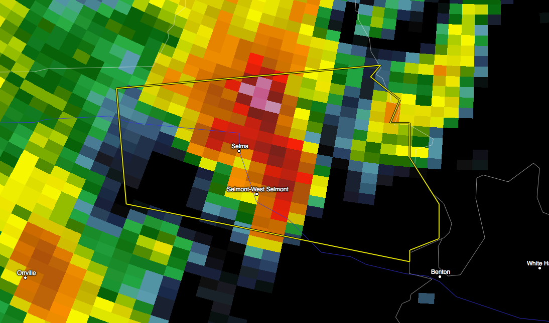
These Severe Weather Storm Warning polygon includes the City of Selma, Al. It is tracking East-North-East and should be clear of this area in 20-30 minutes. This storm will likely be in Autaugaville by 3:25 and Prattville by 3:40. There is currently no indications of a tornado threat associated with this storm.
An extension of this warning was also issued to include Autaugaville and Prattville.
The primary hazards in these warnings are 60 mph winds and hail.
THE NATIONAL WEATHER SERVICE IN BIRMINGHAM HAS ISSUED A
* SEVERE THUNDERSTORM WARNING FOR…
EAST CENTRAL DALLAS COUNTY IN SOUTH CENTRAL ALABAMA…
* UNTIL 330 PM CDT
* AT 258 PM CDT…A SEVERE THUNDERSTORM WAS LOCATED OVER SELMA…
MOVING EAST AT 30 MPH.
HAZARD…60 MPH WIND GUSTS AND QUARTER SIZE HAIL.
SOURCE…RADAR INDICATED.
IMPACT…HAIL DAMAGE TO VEHICLES IS EXPECTED. EXPECT WIND DAMAGE
TO ROOFS…SIDING AND TREES.
* LOCATIONS IMPACTED INCLUDE…
SELMA…SELMONT-WEST SELMONT…GARDNER ISLAND…MEMORIAL STADIUM…
BURNSVILLE…DALLAS COUNTY HORSE ARENA…POTTER STATION…SELMA
DRAG STRIP…CRAIG FIELD AIPORT…EDMUND PETTUS BRIDGE…SKYHARBOR
AIRPORT AND SELMA UNIVERSITY.
Category: Alabama's Weather, Severe Weather
About the Author (Author Profile)
Subscribe
If you enjoyed this article, subscribe to receive more just like it.


