

Unsettled April Weather Continues
An all new edition of the ABC 33/40 Weather Xtreme video is available in the player on the right sidebar of the blog. You can subscribe to the Weather Xtreme video on iTunes by clicking here.
WET DAY: Showers and storms returned to North and Central Alabama today, aided by a wedge front that pushed into Alabama from the east. Some flooding issues have been reported in a few spots; the image below was taken along Alabama 119 in Shelby County between US 280 and US 31 this afternoon (photo from @sparker2374)
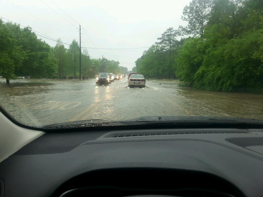
Flooding has also been reported in parts of downtown Birmingham.
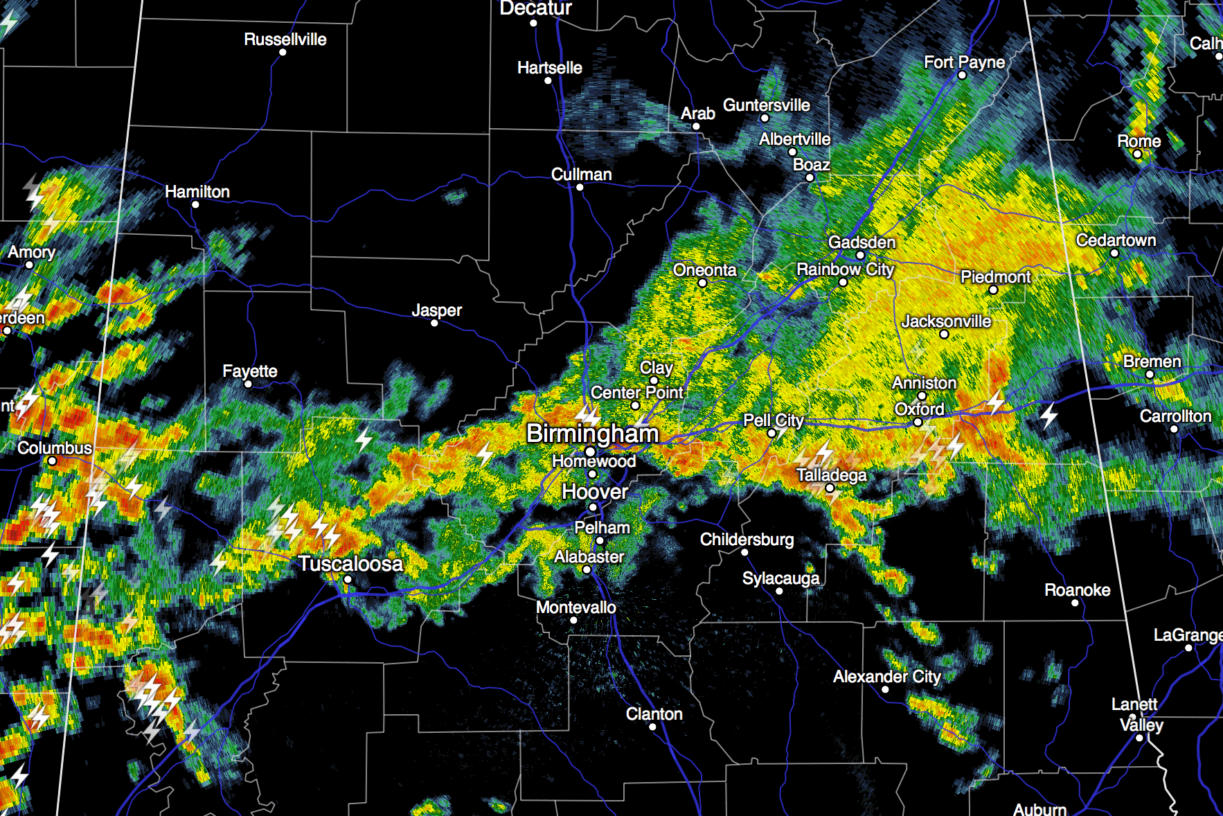
Radar continues to show rain and storms over much of North/Central Alabama…
As expected, it is much cooler over East Alabama with many places dropping into the cool 50s this afternoon.
TOMORROW: Don’t think it will be as wet as today. The wedge front dissipates, and showers become more widely scattered; a decent part of the day should be dry with a high in the 70s. The sun might even peek out at times.
THE ALABAMA WEEKEND: More rain. The high resolution NAM shows rain moving into West Alabama at midday Saturday, becoming widespread during the afternoon and into Saturday night. Sunday will be wet at times as well with occasional showers and thunderstorms. With a large scale upper trough approaching, we will need to monitor weather conditions for severe weather potential, but for now it looks like instability values will be pretty marginal, and the overall risk looks rather low. Rain amounts of 1-2 inches are likely over the weekend, and some flooding issues can’t be totally ruled out (like today). Highs over the weekend will be in the 70s.
A-DAY GAMES: Unfortunately it looks like rain will be likely for the Alabama spring game Saturday afternoon (2:00p CT kickoff) at Bryant-Denny Stadium in Tuscaloosa. Auburn’s game (1:00 CT kickoff) at Jordan-Hare Stadium will begin rain-free, but it turns wet by the second half. Temperatures will be in the low to mid 70s at both venues. Take the rain gear.
NEXT WEEK: We will continue to mention the chance of a few stray showers Monday, but drier air finally returns Tuesday and Wednesday with a good supply of sunshine both days along with lower humidity values. Temperatures should drop into the 40s early Wednesday. Then, later in the week, showers and storms will return. See the Weather Xtreme video for maps, graphics, and more details.
GULF COAST WEATHER: More clouds than sun each day through the weekend from Panama City over to Gulf Shores, with occasional showers and thunderstorms. A flash flood watch remains in effect for Dauphin Island, Gulf Shores, and Pensacola Beach. Highs will be in the 70s, and the sea water temperature this afternoon at the Dauphin Island Sea Lab is 73 degrees.
WEATHER BRAINS: Don’t forget you can listen to our weekly 90 minute netcast anytime on the web, or on iTunes. This is the show all about weather featuring many familiar voices, including our meteorologists here at ABC 33/40.
CONNECT: You can find me on all of the major social networks…
Facebook
Twitter
Google Plus
Instagram
I had a great time visiting with the kids at Hokes Bluff Middle School today… be looking for them on the Pepsi KIDCAM today at 5:00 on ABC 33/40 News! The next Weather Xtreme video will be posted here by 7:00 a.m. tomorrow…
Category: Alabama's Weather
About the Author (Author Profile)
James Spann is one of the most recognized and trusted television meteorologists in the industry. He holds the AMS CCM designation and television seals from the AMS and NWA. He is a past winner of the Broadcast Meteorologist of the Year from both professional organizations.Subscribe
If you enjoyed this article, subscribe to receive more just like it.


