

Occasional Showers/Storms Through Sunday
To make the blog more user friendly for those using phones and tablets, we are now embedding the Weather Xtreme video at the top of individual posts. You can also subscribe to the Weather Xtreme video on iTunes by clicking here.
RADAR CHECK: Rain has ended for now across much of Central and West Alabama, but the rain continues over the eastern counties at mid-afternoon. We are even starting to see a few breaks in the overcast across West Alabama for a change…
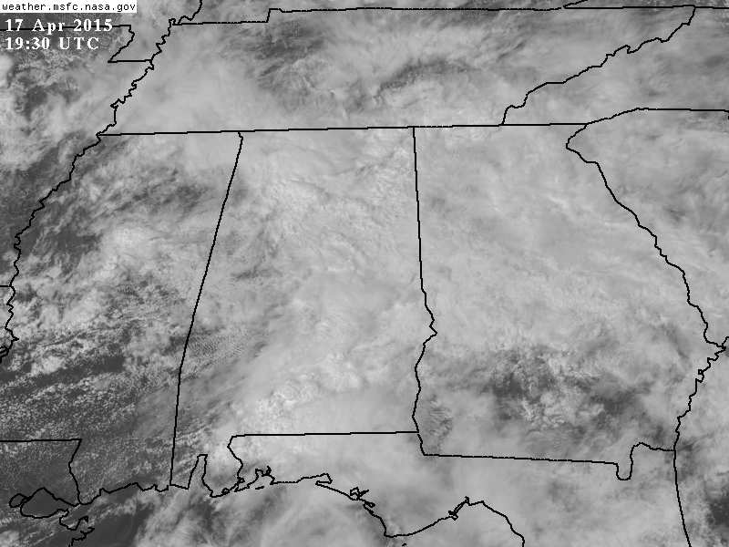
Rain will end across East Alabama in coming hours, and the weather tonight will be relatively quiet, with only isolated showers. Temperatures are generally in the 60s this afternoon, well below average for mid-April in Alabama.
TOMORROW: It continues to look like the best chance of rain will come tomorrow afternoon into tomorrow night. We can’t rule out a few morning showers, but they should be widely spaced. Severe weather is not expected, and tomorrow’s high will be in the mid 70s.
SPRING FOOTBALL: While a passing shower is certainly possible, there is a decent chance much of the A-Day game at Auburn (1:00p CT kickoff at Jordan-Hare Stadium) will be dry tomorrow. For the Crimson Tide A-Day in Tuscaloosa, rain will likely begin at some point during the game, with the higher percentages coming during the second half. Afternoon temperatures will be in the 70s.
TOMORROW NIGHT/SUNDAY: As the upper trough lifts out of the western U.S., dynamic support for thunderstorms will increase. The Storm Prediction Center has most of Alabama in the standard “slight” risk of severe weather Sunday.
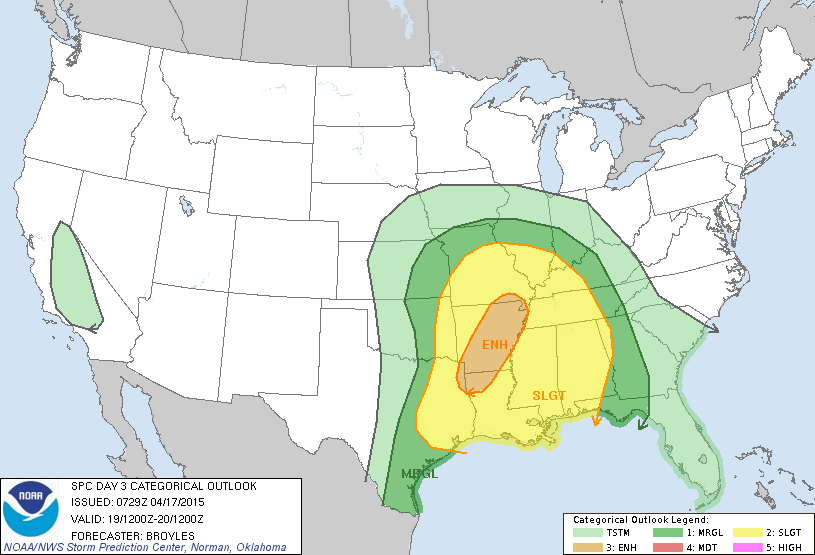
Strong storms are certainly possible early Sunday morning with a low level jet of almost 50 knots setting up across the state, but the instability values are pretty low (CAPE values below 750 j/kg). Perhaps there will be another window for severe storms late Sunday afternoon and Sunday night as the surface front approaches, but the higher wind fields have moved on to the northeast by then. If we do have severe storms Sunday, seems like the primary threat will come from hail and strong gusty winds, although the tornado risk is not zero.
Confidence in the specific timing of convection Sunday is fairly low; models have struggled with this pattern all week. But, one way or another showers and storms are likely Sunday with a high in the 70s.
NEXT WEEK: A few stray showers are possible Monday, especially during the morning hours, then we will enjoy beautiful weather Tuesday and Wednesday, with a good supply of sunshine both days, lower humidity, and cooler nights. Showers return later in the week Thursday and Friday, but for now the severe weather threat seems low. See the Weather Xtreme video for maps, graphics, and more details.
WEATHER BRAINS: Don’t forget you can listen to our weekly 90 minute netcast anytime on the web, or on iTunes. This is the show all about weather featuring many familiar voices, including our meteorologists here at ABC 33/40.
CONNECT: You can find me on all of the major social networks…
Facebook
Twitter
Google Plus
Instagram
I had a great time today visiting with the 2nd graders at Pinson Elementary School… be looking for them on the Pepsi KIDCAM today at 5:00 on ABC 33/40 News! My next Weather Xtreme video will be posted early Monday morning by 7:00… Brian Peters will have the video updates tomorrow and Sunday. Enjoy the weekend!
Category: Alabama's Weather
About the Author (Author Profile)
James Spann is one of the most recognized and trusted television meteorologists in the industry. He holds the AMS CCM designation and television seals from the AMS and NWA. He is a past winner of the Broadcast Meteorologist of the Year from both professional organizations.Subscribe
If you enjoyed this article, subscribe to receive more just like it.


