

Lull Today, Active Sunday
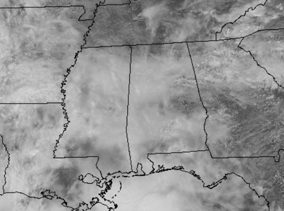
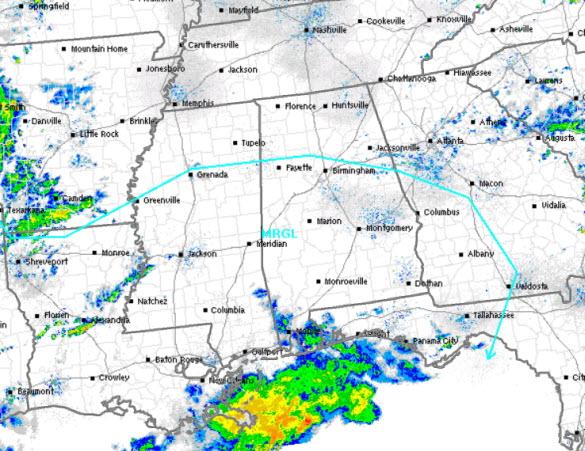
Though it remains cloudy, gray, and cool today, we are not seeing much in the way of rain across the state this afternoon, but of course that will be changing as rain and storms will return to the state as early as this evening. Temperatures this afternoon are in the upper 60s and lower 70s for most of Central Alabama. The SPC does have much of the southern two-thirds of the state outlined in a “marginal” risk for severe weather today, notice the blue line in the map below. Areas along and south of a line from Fayette to Birmingham to Talladega are included in this risk and this will be for storms that arrive late tonight into the pre-dawn hours.
I want to say first off that there is a lot of uncertainty with both rounds of potential storms we could see. The first round will come overnight tonight. Model data suggests showers and storms will begin developing across Mississippi and Alabama this afternoon and this activity will be heading towards Central Alabama during the overnight hours, with the main time frame being from around 12 a.m. until 8 a.m. tomorrow. We will see more of a heavy rain event with limited instability, but there will be still be the threat of storms that will bring with them the threat of hail and strong gusty winds, and while the tornado threat is very low, it is not zero.
However, we do note there is a large expanse of showers and storms across the Northern Gulf of Mexico and these could possibly be impeding our threat of strong storms during the overnight period as the flow from the Gulf of Mexico is blocked. Of course we are watching everything closely, but this ongoing activity could very much benefit us in Central Alabama. We are still going to forecast rain and storms this evening and overnight. What activity we see develop should be pushing out of the area during the late morning hours tomorrow and we should see a break in the action for most of Sunday afternoon and into the evening hours.
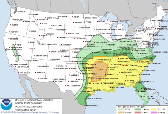
As we look at the latest day 2 convective outlook just issued from the SPC, it shows the entire state of Alabama is included in the “slight” risk for severe weather on Sunday. This is for what could potentially develop late Sunday and lasting into the pre-dawn hours Monday. This second round will be the one that we will have to watch very carefully as this is when the best dynamics will be approaching the area with the upper trough over the southern Plains. While it will be slowly weakening, the air will be more unstable, shear values and lapse rates suggest that some of the storms could produce damaging winds, large hail, and an isolated tornado or two will be possible.
We are continuing to monitor the situation carefully, and we are going to urge everyone to stay weather aware the next 48 hours, especially since the main threat for storms appears to be during the overnight hours; make sure you have ways to get and receive warnings. Always prepare for the worst and hope for the best, and expect surprises when it comes to thunderstorms in Alabama.
Category: Alabama's Weather
About the Author (Author Profile)
Macon, Georgia Television Chief Meteorologist, Birmingham native, and long time Contributor on AlabamaWX. Stormchaser. I did not choose Weather, it chose Me. College Football Fanatic. @Ryan_StinnetSubscribe
If you enjoyed this article, subscribe to receive more just like it.


