Storm Prediction Center Day One Severe Weather Outlook
Here is the SPC Day One Severe Weather Outlook with the individual threat probabilities on the left and the categorical outlook map on the right.
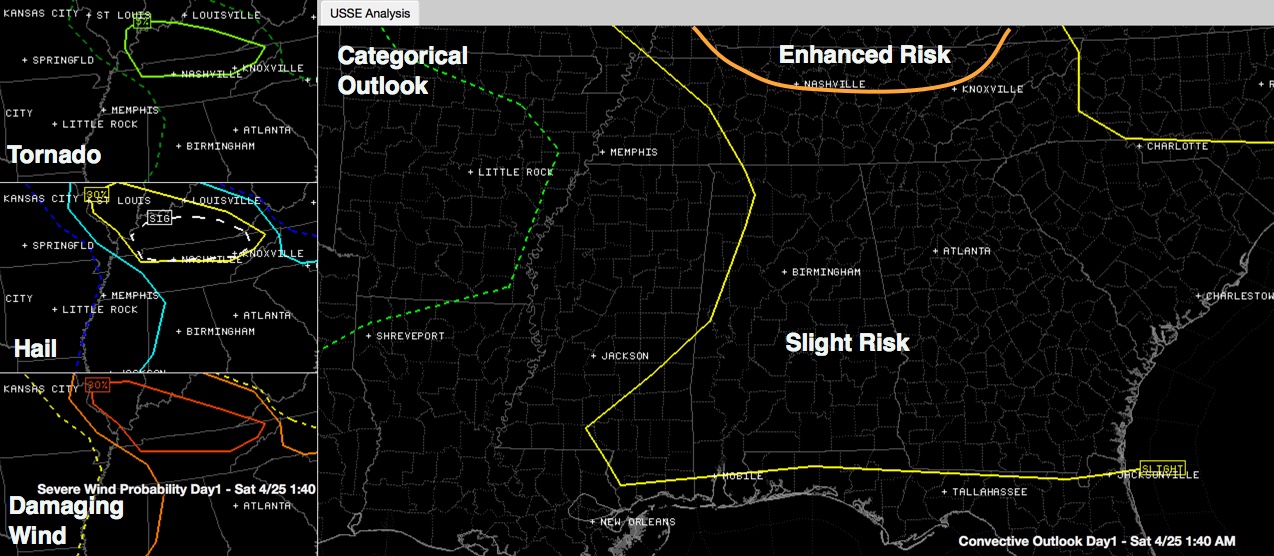
As you can see, most of Alabama is in the standard severe weather risk, which is called “slight”. There is an “enhanced” risk area to the north over northern Tennessee into Kentucky, where dynamics will be better later this afternoon and the airmass hasn’t been worked over my morning convection.
There is a 2% chance of a tornado within 25 miles of any spot over much of Alabama as you can see in the top left panel. To the north, there is an area of 5% probabilities.
The severe hail probability is 15% over much of Alabama as is the severe wind (>58 mph) probability.
Stay weather aware over South Central Alabama this morning in the tornado watch area until 8 a.m. then everyone needs to pay attention this afternoon to see if another round of severe thunderstorms can develop.
Category: Alabama's Weather, Severe Weather
About the Author (Author Profile)
Bill Murray is the President of The Weather Factory. He is the site's official weather historian and a weekend forecaster. He also anchors the site's severe weather coverage. Bill Murray is the proud holder of National Weather Association Digital Seal #0001 @wxhistorianSubscribe
If you enjoyed this article, subscribe to receive more just like it.


