

An Update on Our Situation
By Brian Peters
9:27 AM Saturday
First, I am unable to prepare a Weather Xtreme Video because I am providing weather support to the Honda Indy Grand Prix of Alabama at Barber Motorsports Park in Birmingham. My ‘office’ is an open area with numerous people checking on the latest weather, so the video would be horrible. But I thought I would post a couple of notes about the weather for Central Alabama today.
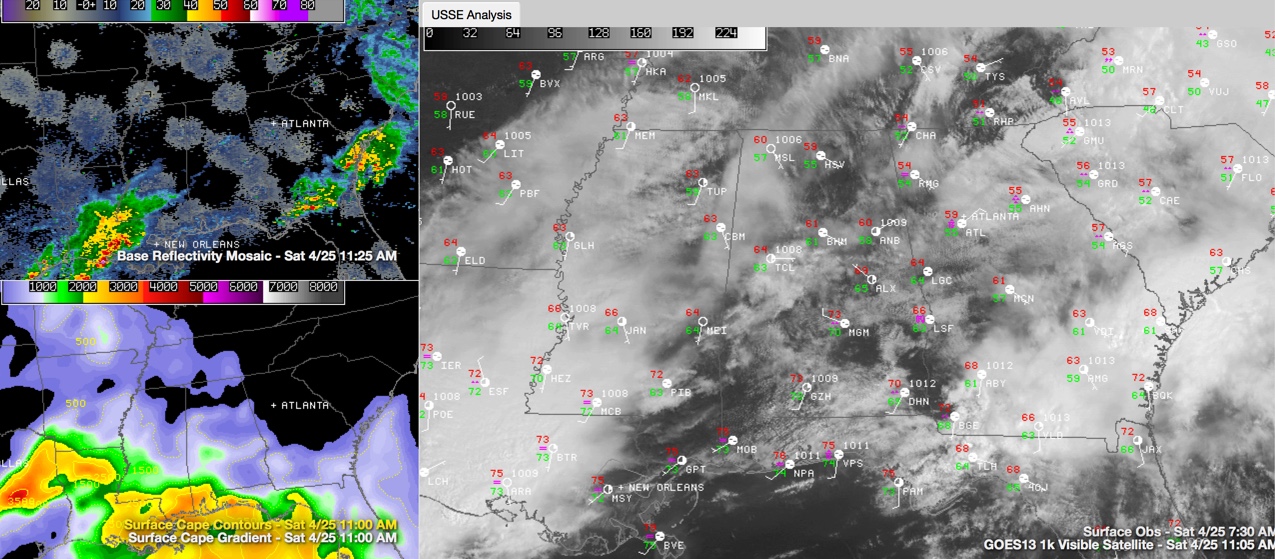
SimuAWIPS image showing region radar (top left), current instability (bottom left) and visible satellite and surface observations (right panel).
First, a large cluster of thunderstorms moved through Central Alabama early this morning helping to stabilize the atmosphere for the time being. By working over the atmosphere so much, it has helped to reduce to some extent the threat of a second round of thunderstorms. The sounding from BMX at 12Z this morning showed a CAPE value of only 6 in the wake of this cluster. In addition to this, another large cluster of storms over Southeast Texas and Southwest Louisiana was producing some additional clouds which may help to reduce the daytime heating across Central Alabama which could conceivably aid in lowering any destabilization of the atmosphere late this morning and into the afternoon. As this cluster moves eastward along the Gulf Coast, it may help to disrupt the moist southerly flow further northward.
Supporting additional development today is the fact that the upper trough axis still remains to our west and northwest. SPC has an enhanced risk of severe thunderstorms in the Ohio River Valley just ahead of this trough. And the GFS continues to project moderately high instabilities over 3,000 j/kg with scattered thunderstorms developing.
Satellite imagery this morning also shows some breaks in the clouds across Central Alabama and Central Mississippi. These breaks will allow for heating of the near surface layer and help with destabilization. I have noticed, however, that the lower clouds have closed off some of the breaks which may slow the destabilizing process.
The HRRR model shows additional thunderstorms developing into the early afternoon, so we will need to be vigilant for this development. The HRRR model continued to trend toward less development into the afternoon for Central Alabama while the NAM continued to be more robust in the development of thunderstorms. The best time period for additional development still remains from the early afternoon into the early evening generally from about 1 to 9 pm. While thunderstorms may not be widespread, those that do develop could pack a good punch!
As always, be weather safe and be sure to have a way to get weather warnings. Stay tuned to the Blog for further updates.
-Brian-
Category: Alabama's Weather, Severe Weather
About the Author (Author Profile)
Brian Peters is one of the television meteorologists at ABC3340 in Birmingham and a retired NWS Warning Coordination Meteorologist. He handles the weekend Weather Xtreme Videos and forecast discussion and is the Webmaster for the popular WeatherBrains podcast.Subscribe
If you enjoyed this article, subscribe to receive more just like it.


