

Could a Watch Be In Our Future?
A potent little mesoscale convective vortex is rotating into Northwest Alabama early on this Memorial Day.
There is very little instability ahead of the system, but it is ingesting unstable air from the south on a strong low level wind. So it is uncertain how long it will be able to maintain itself, but it has impressive rotation and is moving into an area with southeasterly surface winds, so there is a small tornado threat
The SPC has just put out a statement that a tornado watch is possible if the feature holds together.
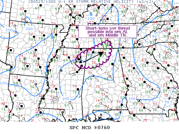
The SPC does not have Alabama outlooked for severe weather today since the threat for severe weather is not significant or widespread enough to warrant a risk forecast. But a small feature like this can sometimes trigger localized severe weather and we will be monitoring it.
There is a moderate risk today over southern Oklahoma and northern Texas into extreme southwestern Arkansas where the SPC feels that a very strong upper level disturbance approaching from the southwest.
Category: Severe Weather
About the Author (Author Profile)
Bill Murray is the President of The Weather Factory. He is the site's official weather historian and a weekend forecaster. He also anchors the site's severe weather coverage. Bill Murray is the proud holder of National Weather Association Digital Seal #0001 @wxhistorianSubscribe
If you enjoyed this article, subscribe to receive more just like it.


