

Severe Thunderstorm Warning for Parts of Shelby County
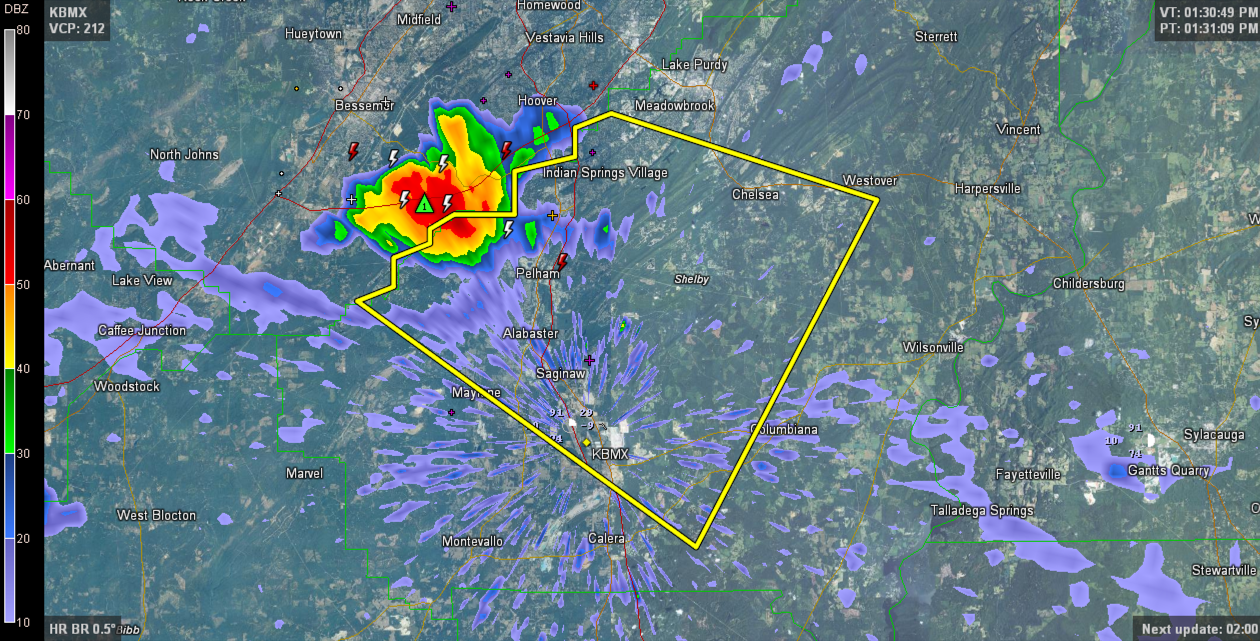
The strong thunderstorm over southern Jefferson County that is moving into Shelby County has prompted a severe thunderstorm warning for much of Shelby County.
THE NATIONAL WEATHER SERVICE IN BIRMINGHAM HAS ISSUED A
* SEVERE THUNDERSTORM WARNING FOR…
CENTRAL SHELBY COUNTY IN CENTRAL ALABAMA…
* UNTIL 215 PM CDT
* AT 133 PM CDT…A SEVERE THUNDERSTORM WAS LOCATED OVER HOOVER
METROPOLITAN STADIUM…OR OVER HELENA…MOVING SOUTHEAST AT 20 MPH.
HAZARD…60 MPH WIND GUSTS.
SOURCE…RADAR INDICATED.
IMPACT…EXPECT DAMAGE TO ROOFS…SIDING AND TREES.
* LOCATIONS IMPACTED INCLUDE…
HOOVER…ALABASTER…PELHAM…HELENA…CALERA…CHELSEA…
COLUMBIANA…INDIAN SPRINGS VILLAGE…OAK MOUNTAIN AMPHITHEATER…
OAK MOUNTAIN STATE PARK…SHELBY COUNTY AIRPORT…RIVERCHASE…
HOOVER VETERANS PARK…SAGINAW…SADDLE LAKE FARMS…BALLANTRAE…
JOE TUCKER PARK…CAMP BRANCH…BOUNDS LAKE AND SILURIA.
Category: Severe Weather
About the Author (Author Profile)
Bill Murray is the President of The Weather Factory. He is the site's official weather historian and a weekend forecaster. He also anchors the site's severe weather coverage. Bill Murray is the proud holder of National Weather Association Digital Seal #0001 @wxhistorianSubscribe
If you enjoyed this article, subscribe to receive more just like it.


