

Severe Thunderstorm Warning: Tuscaloosa & Pickens Counties
THE NATIONAL WEATHER SERVICE IN BIRMINGHAM HAS ISSUED A
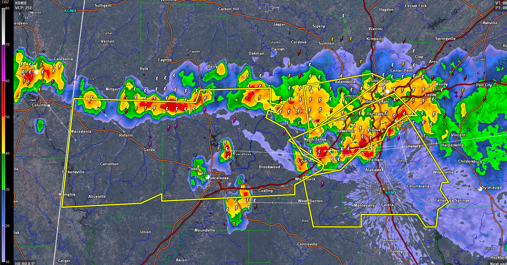
* SEVERE THUNDERSTORM WARNING FOR…
TUSCALOOSA COUNTY IN WEST CENTRAL ALABAMA…
PICKENS COUNTY IN WEST CENTRAL ALABAMA…
* UNTIL 1000 PM CDT
* AT 855 PM CDT…SEVERE THUNDERSTORMS WERE LOCATED ALONG A LINE
EXTENDING FROM NEAR BANKHEAD LOCK AND DAM TO NEAR ETHELSVILLE…
MOVING SOUTH AT 20 MPH.
HAZARD…60 MPH WIND GUSTS AND QUARTER SIZE HAIL.
SOURCE…RADAR INDICATED.
IMPACT…HAIL DAMAGE TO VEHICLES IS EXPECTED. EXPECT WIND DAMAGE
TO ROOFS…SIDING AND TREES.
* LOCATIONS IMPACTED INCLUDE…
TUSCALOOSA…NORTHPORT…ALICEVILLE…GORDO…REFORM…
CARROLLTON…PICKENSVILLE…HOLT…LAKE VIEW…BROOKWOOD…
COALING…VANCE…COKER…ETHELSVILLE…MCMULLEN…TUSCALOOSA
AMPHITHEATER…BEVILL LOCK AND DAM…LAKE WILDWOOD…MERCEDES BENZ
OF ALABAMA AND BINION CREEK LANDING.
Large hail and damaging winds, as well as continuous cloud to ground lightning is occurring with these storms. Take precautionary measures and move indoors immediately.
Category: Severe Weather
About the Author (Author Profile)
Bill Murray is the President of The Weather Factory. He is the site's official weather historian and a weekend forecaster. He also anchors the site's severe weather coverage. Bill Murray is the proud holder of National Weather Association Digital Seal #0001 @wxhistorianSubscribe
If you enjoyed this article, subscribe to receive more just like it.


