

West Alabama Storms
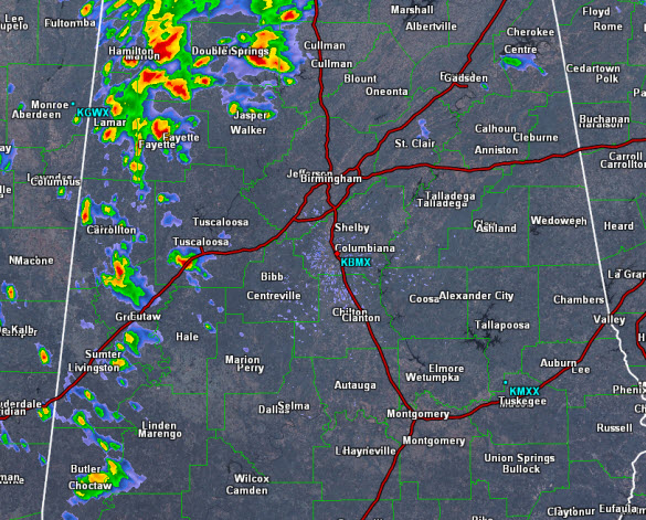
As we have seen the past few days, a weak boundary has been moving across the state. It is moving from east to west, and today it is over West Alabama. It is providing enough uplift to allow the warm and moist air mass over the state to develop plenty of showers and storms.
These storms are not moving much, and the ones that are, have a general northwesterly movement. These storms are producing a lot of lightning, gusty winds, and very heavy rainfall. We have seen a flash flood warning across the Tennessee Valley and we could see a few localized areas of flooding with some of the more intense storms. Just about every storm is west of Interstate 65 and the U.S. 43 corridor is being impacted from the Gulf Coast to the Tennessee Valley.
Today’s showers and storms will continue through the afternoon and evening, and should begin to wind down slowly once the sun sets and daytime heating is loss.
Category: Alabama's Weather
About the Author (Author Profile)
Macon, Georgia Television Chief Meteorologist, Birmingham native, and long time Contributor on AlabamaWX. Stormchaser. I did not choose Weather, it chose Me. College Football Fanatic. @Ryan_StinnetSubscribe
If you enjoyed this article, subscribe to receive more just like it.


