

Humid Today but Drier, Cooler Air Coming
It was a dark and stormy morning! At least for many of the folks across the northern half of Alabama. Here’s a look at the radar from the Shelby County Airport just before 5:30 am. My location was on the southern edge of much of these storms, and my rain gauge picked up just under a half inch of rain.
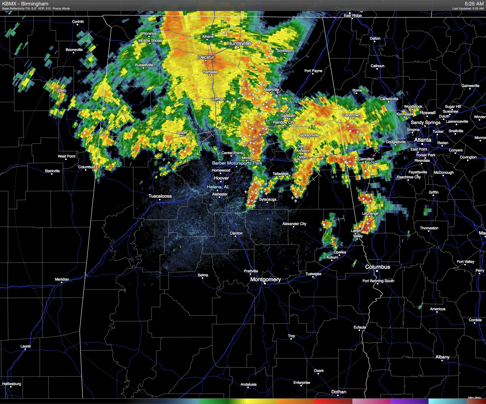
A small short wave trough noted at 500 millibars will continue to traverse the area today keeping thunderstorms likely especially across the northern two thirds of Alabama. An isolated storm or two may be strong, however, I don’t see a widespread case for severe weather today with as much as the atmosphere has been worked over this morning. Clouds and the presence of storms should help to keep temperatures down from yesterday, so I expect to see highs in the middle to upper 80s today.
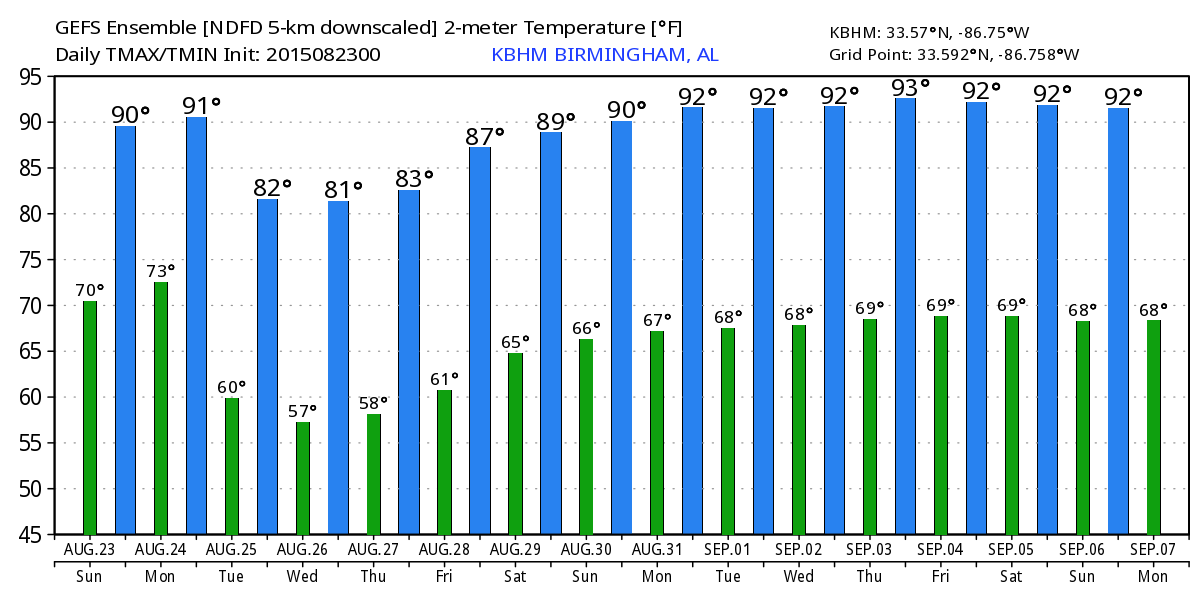
The closed low at 500 millibars over the western Great Lakes will dig into the Great Lakes area through Wednesday. A surface low associated with the upper low will move into Southeast Canada and drag a cold front through the Southeast US Monday and Tuesday. This should bring a pretty reasonable sample of Fall weather to Central Alabama with much drier air as dew points fall off into the 50s. The GFS MOS table even has 59 degrees for a low in Birmingham on Wednesday morning – now that is going to feel mighty nice. I would not be surprised to see some of this typically colder spots make it well down into the 50s.
The closed upper low just north of New York will open up on Thursday, but the trough pattern will stay in place all the way to the end of the month. We’ll be on the edge of the trough and the ridge so I expect temperatures to go back up close to our seasonal averages and the average high for late August in Birmingham is 90 degrees.
Beach goers can expect a fair amount of sunshine each day with about 4 to 6 hours for the start of the week rising to 7 to 9 by the middle of the week. A passing shower may interrupt your sunbathing, but the beaches from Dauphin Island all the way east to Panama City Beach will benefit from the cold front with lowered humidity and highs dipping back to the upper 80s. Sea water temperature still running in the lower 80s.
Danny continued to have everyone’s attention in the Atlantic Basin. Danny remained a rather compact storm and was downgraded to a tropical storm late yesterday and is likely to lose more of it’s punch as it moves into more hostile conditions which include some drier air and unfavorable wind shear. NHC is forecasting Danny to become a depression as it moves through the northern sections of the Leeward Islands and to dissipate shortly after passing the Dominican Republic on Wednesday or early Thursday. While Danny may lose some of its tropical characteristics, it could still bring heavy rain to the Bahamas and South Florida late in the week and into next weekend.
In spite of the weather pattern being so active, SPC only has a marginal risk area for severe storms delineated for today, Day 1, encompassing part of the Ohio River Valley and the Central Great Lakes.
Looking out into week 2 or voodoo country, the GFS promises a mixed bag with a combination of a substantial ridge along the eastern slope of the Rockies with a trough along the East Coast.
Thanks for using the Blog. James Spann will be back with the next edition of the Weather Xtreme Video on Monday morning.
-Brian-
Category: Alabama's Weather
About the Author (Author Profile)
Brian Peters is one of the television meteorologists at ABC3340 in Birmingham and a retired NWS Warning Coordination Meteorologist. He handles the weekend Weather Xtreme Videos and forecast discussion and is the Webmaster for the popular WeatherBrains podcast.Subscribe
If you enjoyed this article, subscribe to receive more just like it.


