

Hot and Humid for Your Labor Day
Sure, the calendar says we’re into meteorological Fall, but don’t expect to see much in the way of change just yet. A front could be approaching the area next weekend, but until then, we’ll just have to muddle along with a hot and humid air mass that will produce mainly afternoon showers.
The upper air pattern will featured an upper ridge for the better part of the week ahead. There is one small hitch in the ridge, though. There is an area of lower pressure over the Southeast US coast that will meander westward for the next several days as it moves along the northern Gulf Coast. The GFS doesn’t do much with this weakness, however, it will bear watching as it could help to focus thunderstorm development until it eventually washes out over the Texas coast.
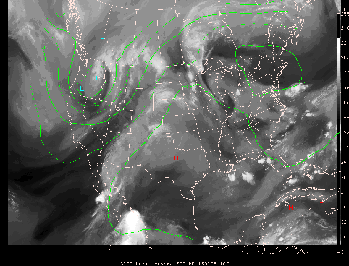
A strong trough promises to bring some change to our weather pattern by next weekend. The trough begins to enter the picture at mid-week in the North Central US, but it doesn’t really become a factor in our weather until next Saturday as a front associated with that trough approaches the Southeast US. Until then, it looks like the humidity will stay up with daily chances for a passing showers along with highs in the upper 80s to lower 90s range.
Not much severe weather action to speak about. SPC, Storm Prediction Center, has a marginal risk area in the North Central US centered primarily on Minnesota and North Dakota. Day 2 features a slight risk area in Minnesota, and Day 3, Monday, we’re back to a marginal risk area in the Central Plains states.
In the Atlantic Basin of the tropics, Fred is still kicking up some waves, but Fred is a mere shadow of his former self. And Fred remained only a threat to shipping. A tropical wave located several hundred miles south of the Cape Verde Islands continued to show signs of organization, and NHC has given it an 80 percent chance of becoming a tropical depression in the next 48 hours. The various computer model projections bring that storm westward toward the Lesser Antilles, and when it is named, it will be called Grace.
Besides being the Labor Day weekend, it is also the start of the 2015 football season. Alabama and Auburn kick off the college season today with neutral site games, and both will be played in venues where rain won’t be an issue one way or another. Auburn against Louisville; the game is today at 2:30 in Atlanta in the Georgia Dome. Dry inside, but outside the dome showers are possible with afternoon temperatures in the 80s. Alabama will take on Wisconsin tonight at 7:00 in a game televised on ABC 33/40 at AT&T Stadium in Arlington, TX. The day will be sunny and hot in the Dallas/Fort Worth metroplex with a high in the mid 90s to near 100F, cooling down into the 70s Saturday night. No need to bring the retractable roof over the stadium with a clear sky.
For you beach goers, scattered showers and storms will be fairly common occurrences along the beautiful beaches of Alabama and Northwest Florida this weekend and for much of the week ahead. You can expect about 6 to 8 hours of sunshine daily from Dauphin Island eastward to Panama City today through the rest of the Labor Day weekend, with the usual risk of a passing thunderstorm from time to time. Highs stay in the upper 80s on the immediate coast, with sea water temperatures mostly in the mid 80s. You can see the complete Gulf Coast 7 Day Planner here. The Gulf Coast Beach Forecast is presented by Gulf Shores Plantation by Mandoki Hospitality Vacation Rentals. Escape to Gulf Shores Plantation where memories last a lifetime.
Looking out into voodoo country, the GFS was showing a trough in the eastern US around the 14th of September. That should help to keep us out of any significant heat. But by the 20th, the upper air pattern transitions back to a trough along the western US coast with weak ridging over the Southeast US with the potential for some traveling short waves moving through the southwesterly flow.
The next Weather Xtreme Video will be posted here first thing on Sunday morning. How early will depend on how late the football games go this evening. Looking forward to some FOOTBALL ! ! !
-Brian-
Category: Alabama's Weather
About the Author (Author Profile)
Brian Peters is one of the television meteorologists at ABC3340 in Birmingham and a retired NWS Warning Coordination Meteorologist. He handles the weekend Weather Xtreme Videos and forecast discussion and is the Webmaster for the popular WeatherBrains podcast.Subscribe
If you enjoyed this article, subscribe to receive more just like it.


