

Improving Weather Ahead
After a period of several days with rather dreary, cloudy, cool weather, there are signs of improving weather ahead. But we’ll have to endure at least one more day of that dreary, cloudy, cool weather before sunshine returns. By the way, the observation site at the Birmingham airport yesterday recorded a high of only 59 degrees which was exactly 20 degrees below the 30-year average for October 3rd. That pesky closed upper low that has been producing the dreary conditions has moved a little, positioned this morning over South Georgia/North Florida while a surface low was hugging the coast of South Carolina. It is expected that all of these will move eastward away from the Southeast US on Monday allowing our weather to improve and the rain to gradually end for South Carolina.
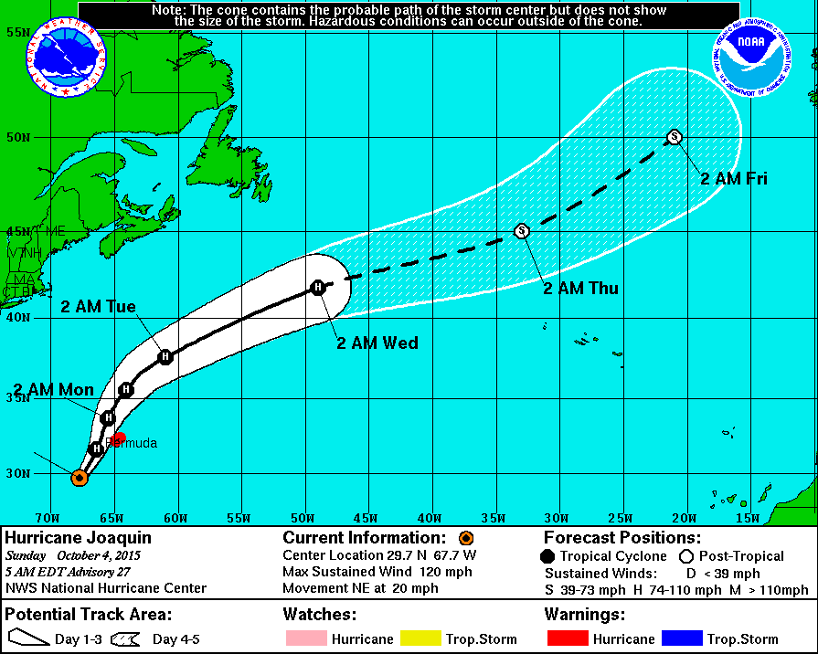
In the tropical Atlantic, Bermuda was bracing for Hurricane Joaquin which was moving north with a slight turn to a more north-northeast track. This will take the center of the category 3 hurricane very close to the western shore of Bermuda where a hurricane warning was in effect. Joaquin should turn more northeast late Monday and speed up as it gets caught up in the faster westerly flow. It will transition into a post-tropical storm on Wednesday. Two other areas of disturbed weather were under the watchful eye of the hurricane center, but neither was expected to develop over the next several days.
Flash flood watches and warnings are in effect today into Monday for much of South Carolina. Be sure to check out the video with some graphics on the rainfall so far in South Carolina where a historic flooding event is unfolding.

The weather will also be improving at the beach. Beach goers will see partly sunny days for Destin and Panama City Beach with a few scattered showers today; there is only a small risk of a shower for Pensacola and Gulf Shores where there will be a good supply of sunshine. The new work week at the beach looks dry and pleasant for the entire Central Gulf Coast with highs approaching 80 degrees. You can see the complete Gulf Coast 7 Day Planner here. The Gulf Coast Beach Forecast is presented by Gulf Shores Plantation by Mandoki Hospitality Vacation Rentals. Escape to Gulf Shores Plantation where memories last a lifetime.
While we watch the upper low over South Georgia move out into the Atlantic, it will replaced over the Southeast US with an upper ridge which should provide dry and sunny weather for us through much of the week ahead. Look for highs to climb back into the lower 80s from Tuesday through Friday. While we will be impacted by an upper ridge, we’ll also be watching the evolution of closed low coming out of southern California reaching the Big Bend area of Texas by Friday. While the closed low does that, it will detach from the trough that will be moving across the Great Lakes area. This will produce a band of showers from the Middle Mississippi River Valley northward into the Great Lakes that is forecast to move off New England by Saturday. While we had model disagreement yesterday, the European and GFS are now in tune with both models keeping the Southeast US dry as the upper low hangs back in the Southwest US. Still this is over 5 days out, so there is time for this scenario to change – maybe several times – but confidence is higher today since the models are so similar in their solutions.
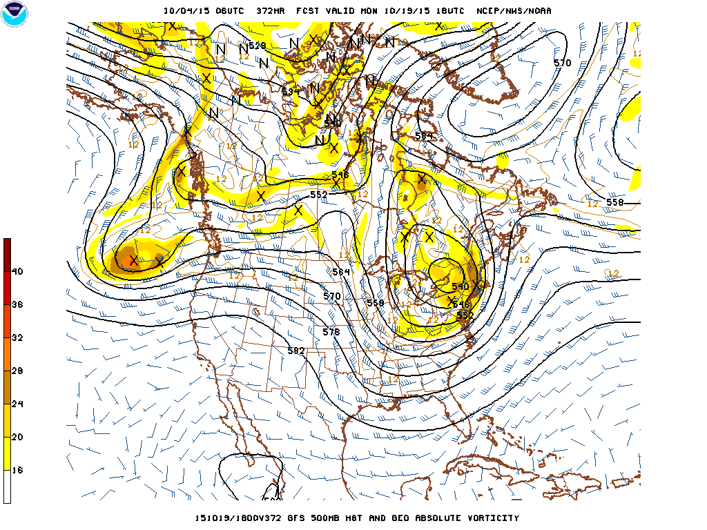
The weather pattern remains pretty active with another strong trough coming across the northern US in the 13th/14th time frame with most of the energy with that trough staying north of us. But by the 18th and into the 19th, the GFS is projecting a closed low over the eastern Great Lakes with a substantial trough extending southward into the Gulf. This scenario is likely to bring a rain event to the Southeast US followed by some unseasonably chilly weather with a strong northwesterly flow aloft.
James Spann will have the next edition of the Weather Xtreme Video here on Monday morning. Don’t forget that you can check back here for updates on Central Alabama’s weather.
-Brian-
Category: Alabama's Weather
About the Author (Author Profile)
Brian Peters is one of the television meteorologists at ABC3340 in Birmingham and a retired NWS Warning Coordination Meteorologist. He handles the weekend Weather Xtreme Videos and forecast discussion and is the Webmaster for the popular WeatherBrains podcast.Subscribe
If you enjoyed this article, subscribe to receive more just like it.


