

Radar View of Joaquin
While we are mostly interested in the weather in Central Alabama, it’s always interesting to peek in on other places that are having weather. And let’s be honest, our interest is usually piqued when the weather in those other locations is bad. So today there is a lot of interest in South Carolina with their epic flooding and in Bermuda as Hurricane Joaquin slips by the island just to the west.
So I thought blog viewers might be interested in the radar view of Joaquin from the Doppler radar located at the L.F.Wade International Airport in Bermuda. The radar is an S-Band Meteor 1500S built by AMS Gematronik purchased by the Department of Airport Operation and is operated by the Bermuda Weather Service.
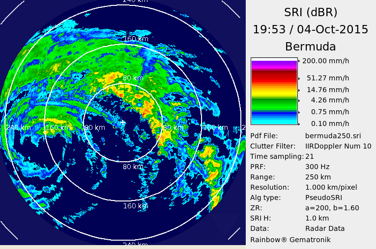
As you might imagine, the weather in Bermuda is horrible. This afternoon, about 90 minutes ago, they reported an ESE wind at 39 mph gusting to 51 mph. Highest gust this afternoon has been 55 mph. The pressure has been falling all afternoon as Joaquin traverses the ocean just west of Bermuda and the latest report was 29.36 inches or 994 millibars.
Looking at the radar image, it appears Joaquin should be due west of Bermuda in about 2 to 3 hours with the eastern most eye wall about 80 km from the radar site.
-Brian-
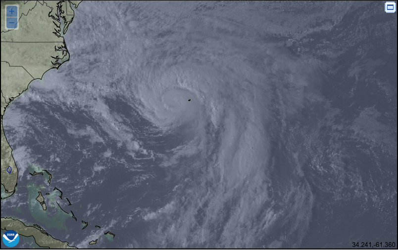
PS I updated this to include a satellite image of Joaquin with Bermuda marked on the map (small black mark just east of Joaquin) for some perspective.
About the Author (Author Profile)
Brian Peters is one of the television meteorologists at ABC3340 in Birmingham and a retired NWS Warning Coordination Meteorologist. He handles the weekend Weather Xtreme Videos and forecast discussion and is the Webmaster for the popular WeatherBrains podcast.Subscribe
If you enjoyed this article, subscribe to receive more just like it.


