

Rain, Wind & Line of Thunderstorms Passing Through the Birmingham Area
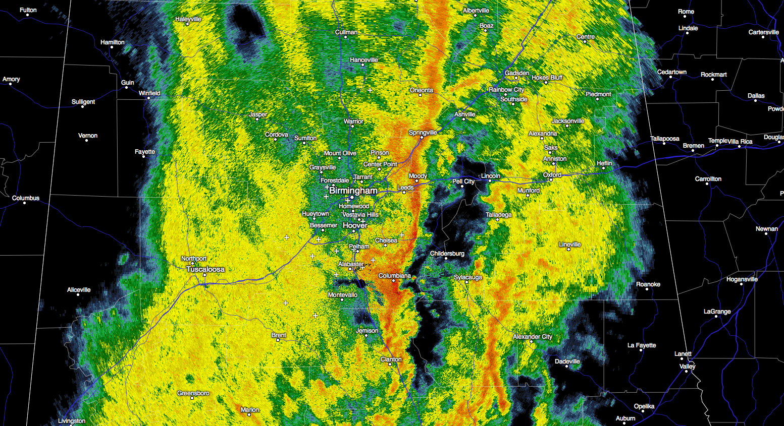
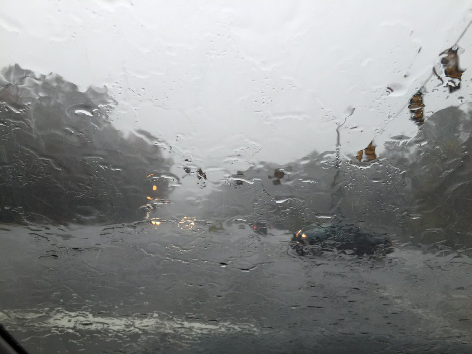
A line of strong thunderstorms is passing through the Jefferson County area, moving northeast at about 40 mph.
A wind advisory is in effect for the cities of Birmingham, Hoover, Columbiana, Pelham, Alabaster until 12:00 noon CST today. This means that sustained winds of 25 mph or higher are expected, with gusts up to 35 mph. Remember that winds this strong can make driving difficult, especially for high profile vehicles, so be careful if you are on the roads!
With the torrential rainfall that has occurred with these storms, we can expect some flooding in poor drainage areas. The rumbling thunder is a reminder that frequent cloud to ground lightning is occurring with these storms. Lightning can strike 15 miles away from a thunderstorm, so be sure to seek safe shelter as these storms pass through.
Category: Alabama's Weather
About the Author (Author Profile)
Bill Murray is the President of The Weather Factory. He is the site's official weather historian and a weekend forecaster. He also anchors the site's severe weather coverage. Bill Murray is the proud holder of National Weather Association Digital Seal #0001 @wxhistorianSubscribe
If you enjoyed this article, subscribe to receive more just like it.


