

Gloomy Look for the Next Few Days
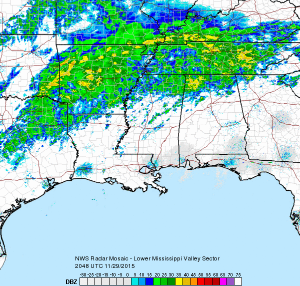
Rain continued on radar this afternoon across primarily the northwestern counties of Alabama. One lone shower area was moving across Walker County and should continue northeastward across Blount County during the late afternoon. As you can see from the radar image below, rain was occurring in a wide band from Northeast Texas across much of Arkansas and Tennessee and portions of northern Mississippi and Alabama.
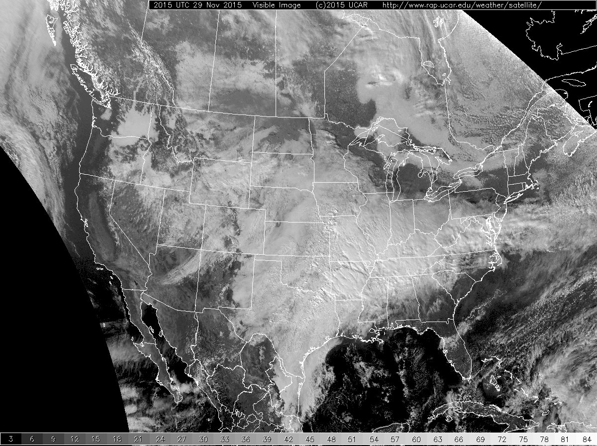
With the upper air pattern stuck with a southwesterly flow, moisture continued to stream out of the Pacific into the Lower Mississippi River Valley. As you’ll note in the satellite image below, much of the eastern two thirds of the US was covered with clouds.
The upper closed low was situated over Utah and Wyoming and was elongated southwest to northeast. The closed low was still forecast to move into the Great Lakes area Wednesday, so the pattern for Alabama will not be changing much. That means off and on rain showers and areas of light rain along with a cloudy sky through Wednesday. Temperatures will not be changing a lot for the next several days, finally cooling down a bit from Wednesday into next weekend as we see lows in the 40s and highs mainly in the 50s.
-Brian-
Category: Alabama's Weather
About the Author (Author Profile)
Brian Peters is one of the television meteorologists at ABC3340 in Birmingham and a retired NWS Warning Coordination Meteorologist. He handles the weekend Weather Xtreme Videos and forecast discussion and is the Webmaster for the popular WeatherBrains podcast.Subscribe
If you enjoyed this article, subscribe to receive more just like it.


