

Tornado Warning for Jefferson County!
UPDATE 451PM
Matthew Grantham at the NWS is monitoring our tornadic storm. The warning is being allowed to expire. But this storm is still very dangerous and could spin back up at any time.
UPDATE 448PM
Possible tornado is passing just east of Hueytown, between Hueytown and Brighton. It will pass near or just west of Brighton, Midfield and Fairfield. The circulation seems to have weakened slightly, but has a history of cycling up and down. A funnel cloud was reported near Alabama Adventure at 438 p.m.
ORIGINAL POST
Radar shows strong indication of a developing tornado near North Johns or just southwest of Bessemer at 426 p.m.
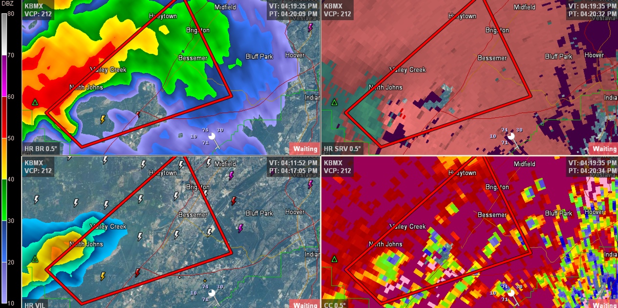
It is moving northeast and could affect:
I-59 between MM 104 and MM 113
Bessemer
Hueytown
SW Bessemer
Pleasant Grove
Lipscomb
Brighton
McAdory
McCalla
Weller
The Promenade
Tannehill
and Dolomite
This same storm produce a confirmed tornado near Vance. Trees were reported down there.
THE NATIONAL WEATHER SERVICE IN BIRMINGHAM HAS ISSUED A
* TORNADO WARNING FOR…
SOUTH CENTRAL JEFFERSON COUNTY IN CENTRAL ALABAMA…
* UNTIL 500 PM CST
* AT 424 PM CST…A SEVERE THUNDERSTORM CAPABLE OF PRODUCING A
TORNADO WAS LOCATED OVER NORTH JOHNS…OR 8 MILES WEST OF
BESSEMER…MOVING NORTHEAST AT 20 MPH.
HAZARD…TORNADO.
SOURCE…RADAR INDICATED ROTATION.
IMPACT…FLYING DEBRIS WILL BE DANGEROUS TO THOSE CAUGHT WITHOUT
SHELTER. MOBILE HOMES WILL BE DAMAGED OR DESTROYED.
DAMAGE TO ROOFS…WINDOWS AND VEHICLES WILL OCCUR. TREE
DAMAGE IS LIKELY.
Category: Alabama's Weather, Severe Weather
About the Author (Author Profile)
Subscribe
If you enjoyed this article, subscribe to receive more just like it.


