

Potentially Strong Thunderstorms N MS
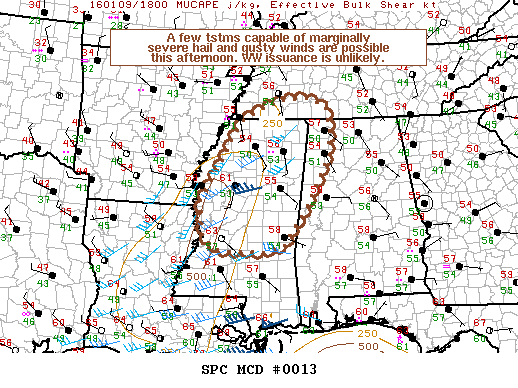
For the area previously outlooked by SPC with a marginal rating, it continues to look like we may see some strong thunderstorms, but in their mesoscale discussion, SPC does not anticipate issuing a watch.
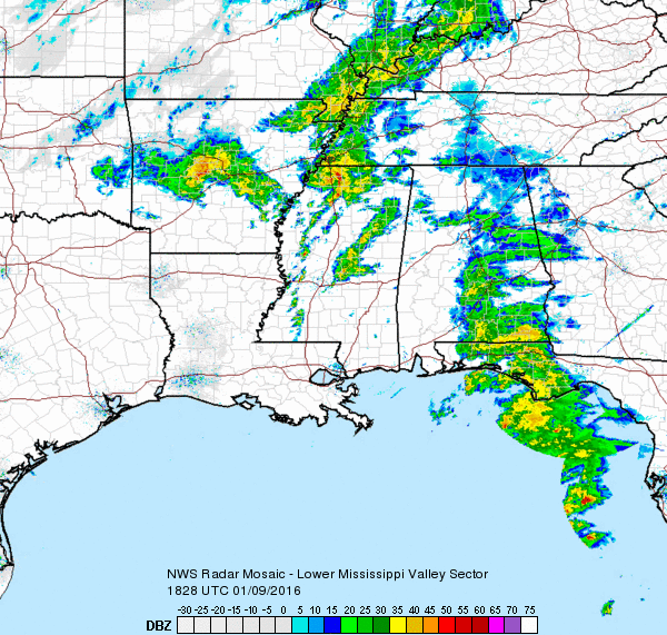
A strong vorticity maxima was moving across Arkansas while radar showed a broken line of convection from just southeast of Memphis southward through the western portion of Mississippi. While satellite imagery has shown some breaks in the clouds across portions of Mississippi, temperatures have only risen to around 60 or 61 degrees. Dew points remain low, too, with those values in the lower and middle 50s. This little bit of heating has allowed CAPE values to rise into the 250 to 500 j/kg range. There appears to be some shear, but it looks like the severe weather threat would be limited to some hail and some gusty wind. Even those are limited somewhat by relatively weak low level lapse rates.
For most of Alabama the weather will remain dreary with additional light rain possible through the afternoon and evening hours. Rain chances will dive toward zero as soon as the front passes your location with a switch in the wind to the west-northwest. Frontal passage at Birmingham is projected to come at or slightly after midnight tonight.
Naturally the conditions will be watched for any further development, but for now it looks like storms should remain below severe limits.
-Brian-
Category: Alabama's Weather
About the Author (Author Profile)
Brian Peters is one of the television meteorologists at ABC3340 in Birmingham and a retired NWS Warning Coordination Meteorologist. He handles the weekend Weather Xtreme Videos and forecast discussion and is the Webmaster for the popular WeatherBrains podcast.Subscribe
If you enjoyed this article, subscribe to receive more just like it.


