

Weekend Model Madness
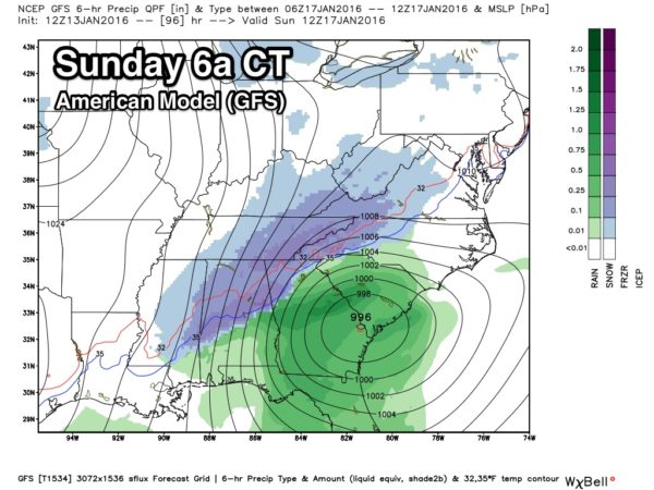
New global model data has arrived (the 12Z runs), and we still have a huge difference in the GFS (American) vs the ECMWF (European). The GFS develops a surface low southeast of here, suggesting potential for some accumulating snow across North/Central Alabama Saturday night and early Sunday…
However, the Euro is bone dry…
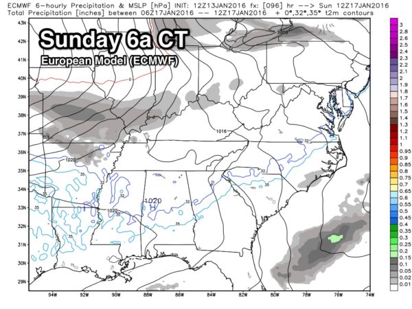
The ECMWF model has performed much better in the medium range this year, and is supported by the Canadian global model. And, the NAM, which runs out to 84 hours, seems to be leaning toward the dry solution as well. The SREF ensemble is looking pretty dry as well.
I will have a full forecast discussion and a new Weather Xtreme video posted by 3:30, but for now I still believe the dry solution is correct based on the pattern, and the amount of dry air expected over North Alabama over the weekend.
But, this is simply to let you know there is a degree of uncertainty in the weekend forecast. Stay tuned.
Category: Alabama's Weather
About the Author (Author Profile)
James Spann is one of the most recognized and trusted television meteorologists in the industry. He holds the AMS CCM designation and television seals from the AMS and NWA. He is a past winner of the Broadcast Meteorologist of the Year from both professional organizations.Subscribe
If you enjoyed this article, subscribe to receive more just like it.


