

Tornado Watch Soon for North and Central Alabama
The latest from the SPC highlights the threat of a few strong tornadoes for the next few hours over western Alabama into Middle Tennessee.
The potential watch area is outlined in pink.
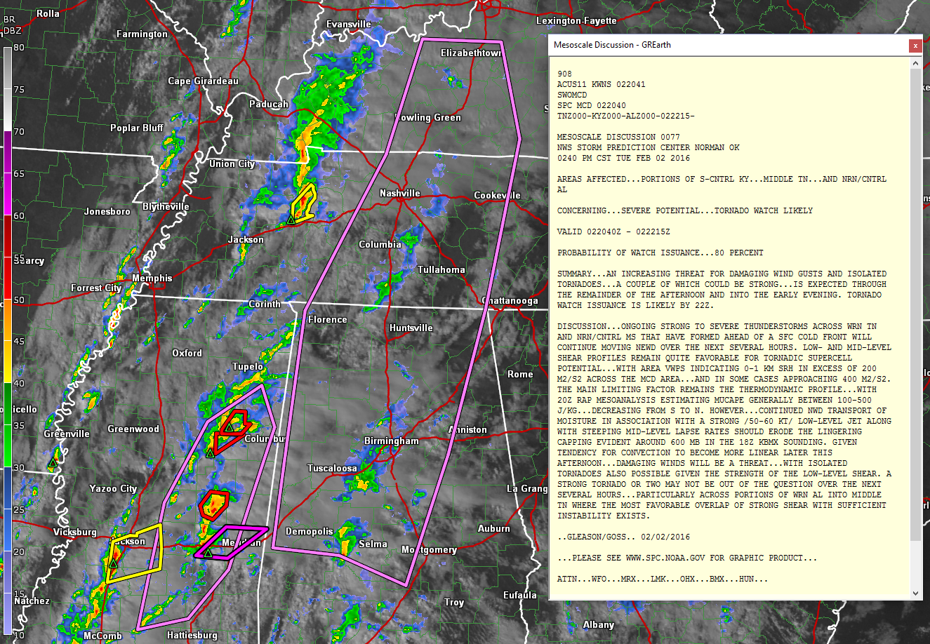
Click the image to enlarge the graphic and read the full discussion.
Highlights:
…Watch likely to be issued by 4 p.m.
…Low and mid level wind shear profiles are quite favorable for tornadic supercells.
…Instabilities have been weak but are increasing. CAPE values now between 500-1,000 j/kg over western Alabama.
…The cap over Central Alabama has been eroded.
CONFIRMED TORNADO OVER EASTERN MISSISSIPPI
Radar indicates tornado debris south of Newton, just south of I-20 in Mississippi. This tornado will cross the interstate and stay west and northwest of Meridian. This tornado warning is show in purple. The other tornado warnings that are in effect are show in red. Severe thunderstorm warnings are in yellow.
Category: Alabama's Weather, Severe Weather
About the Author (Author Profile)
Bill Murray is the President of The Weather Factory. He is the site's official weather historian and a weekend forecaster. He also anchors the site's severe weather coverage. Bill Murray is the proud holder of National Weather Association Digital Seal #0001 @wxhistorianSubscribe
If you enjoyed this article, subscribe to receive more just like it.


