

Timing and Impact
Here is a look at the HRRR radar projection for this evening.
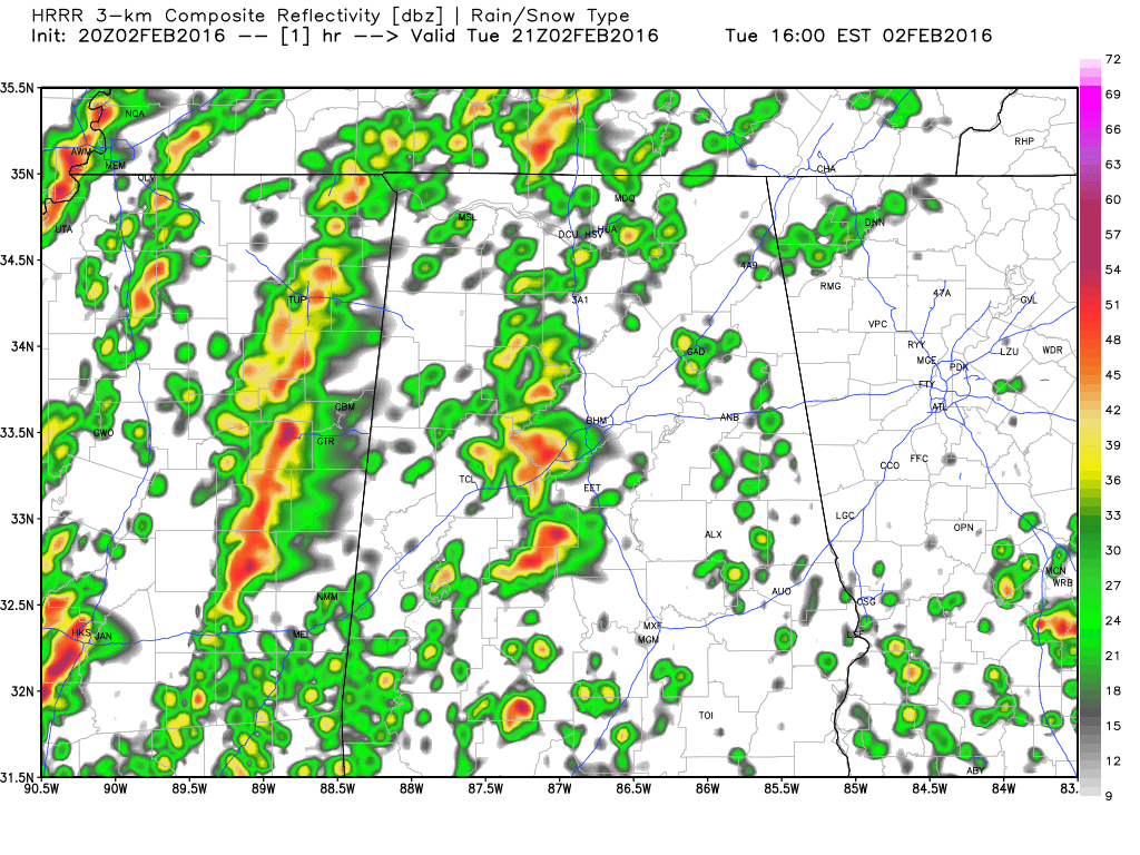
Here is my thinking.
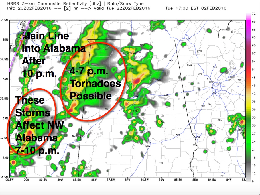
Four phases of weather will impact Alabama tonight:
1. Run of the mill showers and storms from Marshall County down through Blount, Jefferson and Bibb Counties will not be severe as they lift northeastward.
2. Tornadic supercell moving into Pickens County will continue to produce a large and dangerous tornado according to spotters and emergency management. Take cover as it approaches. This activity will impact West Central Alabama between now and 7p.m. A powerful low level jet at 5,000 feet with winds over 60 mph will continue to power these storms. Be aware that there are more lined up back into Newton County MS.
3. Activity back to the east of Jackson will follow the tornadic storms. Damaging winds will be the main threat. This activity will push across Northwest Alabama between 7-10 p.m.
4. The main squall line ahead of the cold front will arrive in Northwest Alabama around 9 p.m. and move across Northwest Alabama between 10 p.m. and midnight. It will follow this rough timetable:
Jasper 1 a.m.
Cullman/Tuscaloosa 2 a.m.
Birmingham 3 a.m.
Pell City 4 a.m.
Anniston 5 a.m.
Damaging winds will be the main threat with the main threat.
Category: Alabama's Weather, Severe Weather
About the Author (Author Profile)
Bill Murray is the President of The Weather Factory. He is the site's official weather historian and a weekend forecaster. He also anchors the site's severe weather coverage. Bill Murray is the proud holder of National Weather Association Digital Seal #0001 @wxhistorianSubscribe
If you enjoyed this article, subscribe to receive more just like it.


