

9:45 Notes
The tornado watch will likely be extended past 10 p.m. for at least some of the counties.
Beginning to get concerned about flooding, especially across parts of Lamar, Marion, Fayette and Winston Counties. An areal flood advisory has been issued for parts of the aforementioned counties.
Ahead of the main rain area, which extends out of eastern Mississippi across Northwest Alabama, an area of confluence is funneling heavy showers noth northeastward from Southwest Alabama all the way through the Birmingham Metro area and on into Northeast Alabama.
There is still 500-750 joules of instability over Pickens and Tuscaloosa Counties, with less than 250 joules elsewhere across almost all of North and Central Alabama. But shear values continue to be off the charts with over 300 m2/s2 of low level helicity. Bulk shear is high as well, at over 50 knots. And we are watching an increasing low level jet ramping up over eastern Mississippi and Northwest Alabama. All this keeps us concerned that there could be isolated tornadoes and a damaging wind threat.
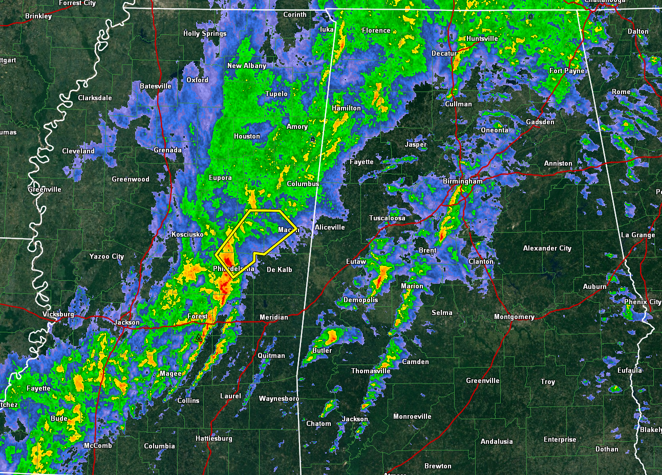
A new severe thunderstorm warning was just issued for Noxubee, Neshoba and Winston Counties.
A tornado was reported at 8:15 p.m. just south of Beaverton in Lamar County. Trees are down across that area.
Category: Alabama's Weather, Severe Weather
About the Author (Author Profile)
Bill Murray is the President of The Weather Factory. He is the site's official weather historian and a weekend forecaster. He also anchors the site's severe weather coverage. Bill Murray is the proud holder of National Weather Association Digital Seal #0001 @wxhistorianSubscribe
If you enjoyed this article, subscribe to receive more just like it.


