A Picture Perfect Day
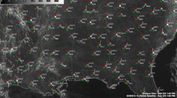
Another picture perfect day is in progress across Alabama. Skies are mostly clear with the exception of some patchy high cirrostratus clouds that are fleeing across the firmament.
Temperatures are in the upper 60s and lower 70s at 2 p.m. It was 68F at Tuscaloosa, 67F at BHM, 66F at the Shelby County Airport and 69F in Anniston.
The nearest rain to Alabama is retreating storms off the coast of North and South Carolina. They are part of that big upper trough and strengthening surface low moving off the East Coast. That is the same system that brought rain and storms to Alabama on Thursday.
We have benign winds over Alabama this afternoon, but winds are already becoming quite strong over the Plains ahead of our next storm system. Winds are gusting to 45 mph at Concordia KS and 37 mph at Oklahoma City. Red flag warnings are are in effect for wide area from El Paso to Kansas City for an extremely high fire danger.
The big trough that will be our next weather maker is crashing on shore in California today. Winter storm warnings are in effect for the Sierras of California, where up to a foot of snow will fall at Yosemite.
Flash flood watches are in effect for Central California where over an inch of rain may cause flooding later today and tonight. As much as 2.3 inches of rain is expected to fall over parts of Southern California as well. I don’t think you will hear them complain, however.
At one of my favorite places, Telluride, Colorado, another 5-10 inches of snow could fall in showers through Monday, with higher amounts above 10,000 feet. Winds just gusted to 57 mph at Gold Hill in the Telluride Ski Resort, where is was 22F.
A stubborn and powerful Bermuda high will block the progress of this system and keep us dry through Wednesday. Look for showers and storms Thursday, Friday, Saturday and Sunday, but the heaviest rains and severe weather will stay west of us. Our heaviest rain will come on Friday and Friday night when over an inch could fall. Temperatures will be mild to warm all week, with highs in the 70s and lows in the 50s through the next fourteen days or so!
Category: Alabama's Weather, Headlines


