Alabama 811 | Know What's Below.

Archive for February 14th, 2010

At Daybreak Sunday

At Daybreak Sunday

| February 14, 2010 @ 6:55 am | 15 Replies

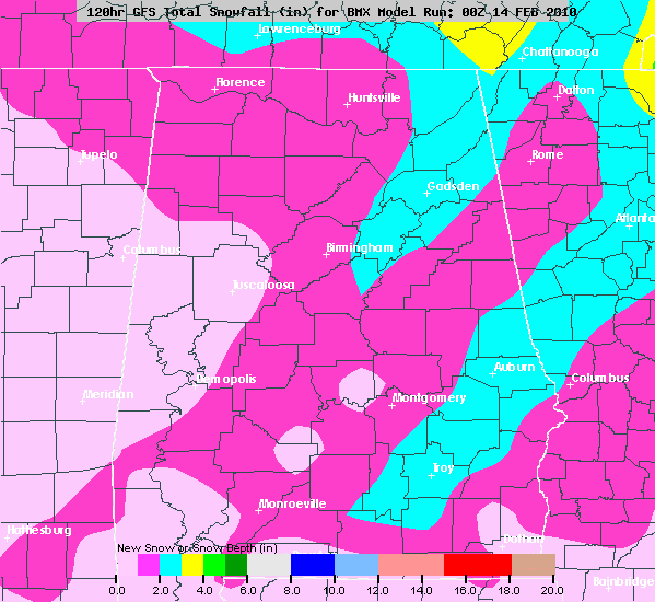
Brian will be along with a full discussion and Weather Xtreme video shortly. A few notes… *The latest model runs are actually in pretty decent agreement… potential for a 1 to 2 inch snow late tonight for Birmingham, with potential heavier amounts over Northeast Alabama. Not so sure Tuscaloosa sees that much… one way or […]

Read More

As Daybreak Approaches

As Daybreak Approaches

| February 14, 2010 @ 6:17 am | 20 Replies

Nothing going on in Alabama at this hour. Radar does indicate some light precipitation over extreme North Alabama but not making its was to the ground. 6 am surface analysis shows a low pressure just beginning to develop over the SE Missouri “Bootheel” Brian will along in a couple of hours with a complete video […]

Read More

Here We Go Again–Winter Storm!

Here We Go Again–Winter Storm!

| February 14, 2010 @ 4:30 am | 1 Reply

URGENT – WINTER WEATHER MESSAGE NATIONAL WEATHER SERVICE BIRMINGHAM AL 337 AM CST SUN FEB 14 2010 …SIGNIFICANT WINTER STORM EXPECTED SUNDAY NIGHT THROUGH MONDAY MORNING… BLOUNT-ETOWAH-CALHOUN-CHEROKEE-CLEBURNE-ST. CLAIR- INCLUDING THE CITIES OF…ONEONTA…GADSDEN…ANNISTON…CENTRE… HEFLIN…PELL CITY…MOODY 337 AM CST SUN FEB 14 2010 …WINTER STORM WARNING IN EFFECT FROM 9 PM THIS EVENING TO NOON CST MONDAY… […]

Read More