Alabama 811 | Know What's Below.

Archive for November, 2014

Watch County Notification

Watch County Notification

| November 23, 2014 @ 2:44 pm

This is the text of a severe warning from the National Weather Service for part of the AlabamaWX.com coverage area. Standby for more details to be added to this post by our meteorologists. WWUS64 KBMX 232043 WCNBMX WATCH COUNTY NOTIFICATION FOR WATCH 558 NATIONAL WEATHER SERVICE BIRMINGHAM AL 243 PM CST SUN NOV 23 2014 […]

Read More

Severe Weather Threat Winding Down

Severe Weather Threat Winding Down

| November 23, 2014 @ 2:38 pm

The rain has ended at the Birmingham Airport and it appears that we will fall just short of one inch of rain today. 0.89 inches had fallen through 2:12 p.m Still, we are grateful for the beneficial rains and even more grateful that severe weather has not been widespread across the state. It does appear […]

Read More

Tornado Warning Barbour County (Possible TDS at 2:10)

Tornado Warning Barbour County (Possible TDS at 2:10)

| November 23, 2014 @ 2:00 pm

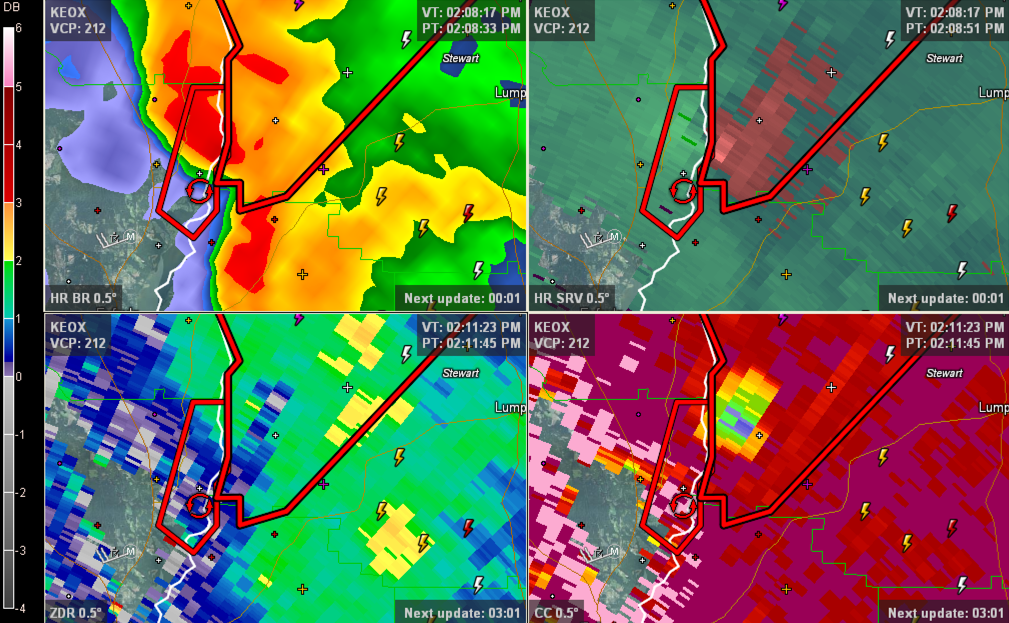
This storm likely produced a tornado as it crossed the Chattahoochee River into Georgia around 2:10. Check out the Tornado Debris Signature from the Fort Rucker Radar. It is evidenced by the low values (blues) on the correltaion coefficient panel (lower right panel on graphic). THE NATIONAL WEATHER SERVICE IN BIRMINGHAM HAS ISSUED A * […]

Read More

Watch County Notification

Watch County Notification

| November 23, 2014 @ 1:54 pm

This is the text of a severe warning from the National Weather Service for part of the AlabamaWX.com coverage area. Standby for more details to be added to this post by our meteorologists. WWUS64 KBMX 231953 WCNBMX WATCH COUNTY NOTIFICATION FOR WATCH 558 NATIONAL WEATHER SERVICE BIRMINGHAM AL 153 PM CST SUN NOV 23 2014 […]
Read More

Tornado Warning Russell County

Tornado Warning Russell County

| November 23, 2014 @ 1:48 pm

Radar indicated rotation approaching Seale in Russell County is the trigger for this tornado warning. It is moving in the direction of Phenix City. This for panel radar image shows (from top left) 1. an inflow notch on the reflectivity display, 2. rotation on the strom relative velocity, 3. nothing on the correlation coefficient panel […]

Read More

Rain/Storms Moving Northeastward

Rain/Storms Moving Northeastward

| November 23, 2014 @ 1:19 pm

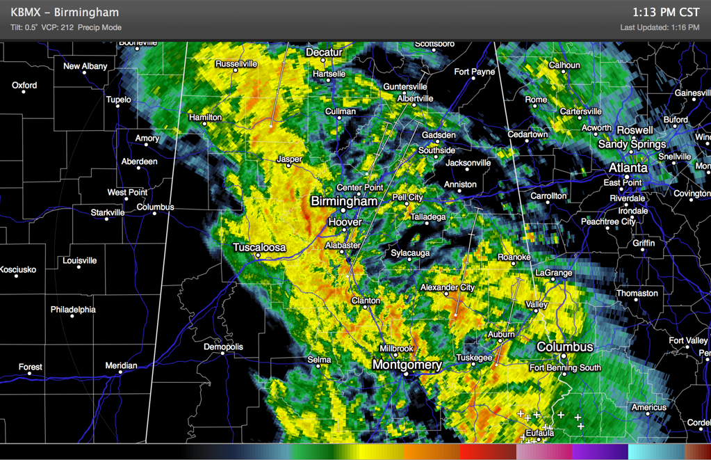
Well, as advertised rain and thunderstorms are pushing northeastward across much of Alabama on this Saturday afternoon. Rain is overspreading the Birmingham Metro at this hour. But the storms are not severe. So far there have been a couple of severe thunderstorm warnings in South Alabama and the NWS in Birmingham had to issue a […]

Read More

Tornado Watch for Southeast Alabama

Tornado Watch for Southeast Alabama

| November 23, 2014 @ 12:35 pm

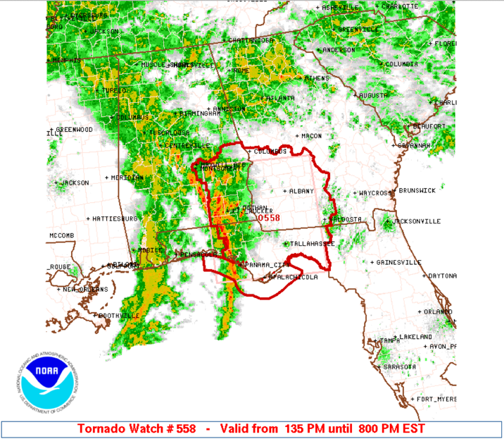
The NWS has issued a tornado watch for areas south of I-85. It goes until 7 p.m. but the activity should be out of Alabama by 5 p.m. Counties included are: Barbour, Bullock, Lee, Macon, Montgomery, Pike, Russell [AL] till 7:00 PM CST. Cities included are Auburn, Eufaula, Montgomery, Opelika, Phenix City, Troy, Tuskegee and […]

Read More

Tornado Warning Barbour, Bullock and Pike in SE Alabama

Tornado Warning Barbour, Bullock and Pike in SE Alabama

| November 23, 2014 @ 12:20 pm

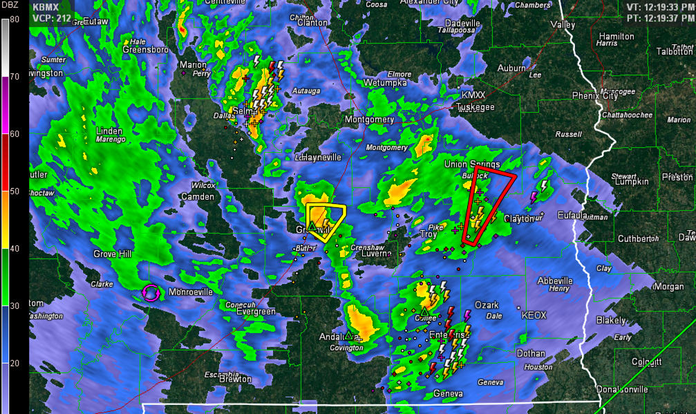
Storms are starting to intensify over South Alabama and the Florida Panhandle early this afternoon. This tornado warning is for radar indicated rotation along the Pike/Bullock/Barbour County line. The NWS in Mobile has a severe thunderstorm warning in effect for Butler County around Greenville. THE NATIONAL WEATHER SERVICE IN BIRMINGHAM HAS ISSUED A * TORNADO […]

Read More

Watching Band of Storms Forming Over West Alabama

Watching Band of Storms Forming Over West Alabama

| November 23, 2014 @ 11:32 am

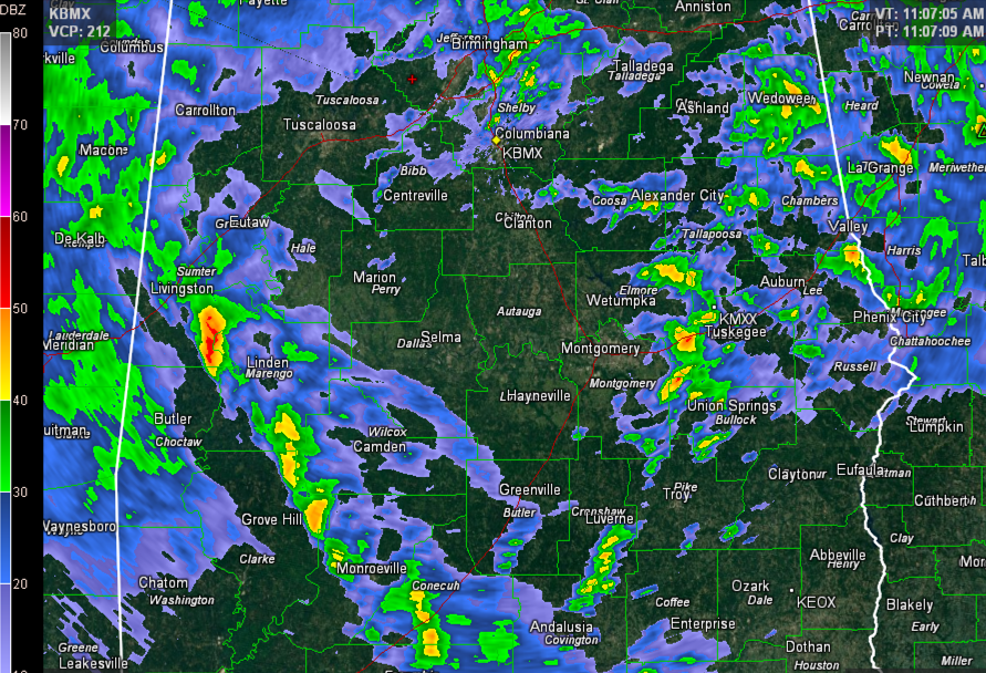
Showers and embedded thunderstorms are fairly widespread across North Central and East Central Alabama late this morning. A band of storms over Southwest and South Alabama is the main concern for Central Alabama though as we head toward the afternoon hours. That band extends from near Macon, MS to near Brewton in South Alabama. It […]

Read More

Storms Lifting into Birmingham Metro

Storms Lifting into Birmingham Metro

| November 23, 2014 @ 10:36 am

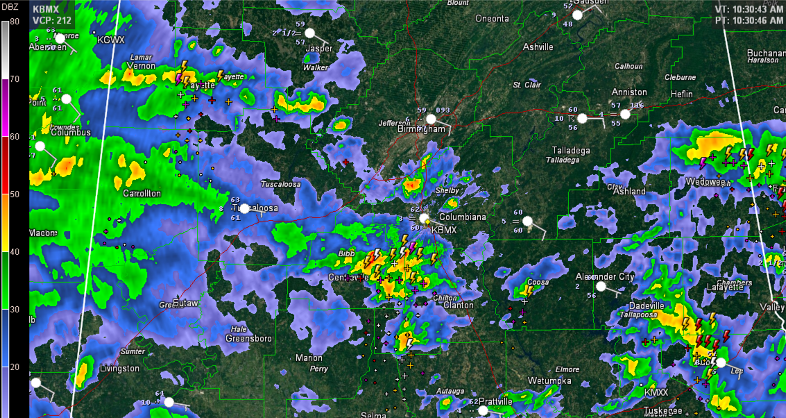
Thunderstorms over Bibb and western Chilton County are lifting north northeastward toward the Birmingham Metro at this hour. They will affect Shelby County between 10:40 – 11 a.m. and then move across Jefferson County between 11 – 11:45 a.m. These storms are elevated, meaning their instability source is above the surface. That makes it hard […]

Read More

Quick Look at Alabama Weather Situation – 9:45 a.m.

Quick Look at Alabama Weather Situation – 9:45 a.m.

| November 23, 2014 @ 9:45 am

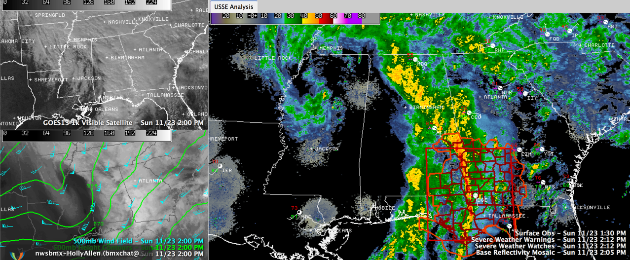
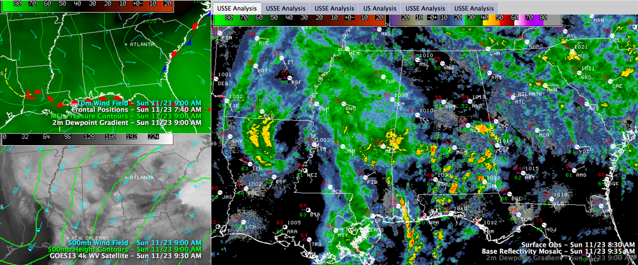
Here is a quick look at the Alabama Weather Situation on this Sunday morning. A dynamic weather system is affecting the Deep South and will bring widespread rain and thunderstorms to Alabama today, including a severe weather threat for parts of the area. The upper level disturbance responsible for the active weather is west of […]

Read More

The November 1950 Cold Wave

The November 1950 Cold Wave

| November 23, 2014 @ 9:00 am

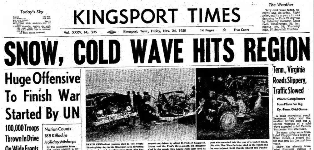
Alabamians paid little attention to the weather forecast on Thanksgiving morning, November 23, 1950. The Birmingham News carried a lead article about the many blessings of the day, including bountiful food, talking about the day’s candied yams, crisp white celery, plump olives and a golden brown roasted turkey. Headlines told of a Thanksgiving Eve crash […]

Read More

Storms Today, Colder Tuesday

Storms Today, Colder Tuesday

| November 23, 2014 @ 7:09 am

An all new edition of the ABC 33/40 Weather Xtreme video is available in the player on the right sidebar of the blog. You can subscribe to the Weather Xtreme video on iTunes by clicking here. Parts of Alabama awoke to some showers stretching from just north of Tuscaloosa to Mt. Cheaha around daybreak. Rainfall […]

Read More

An Update on the Severe Weather Situation for Tomorrow

An Update on the Severe Weather Situation for Tomorrow

| November 22, 2014 @ 9:05 pm

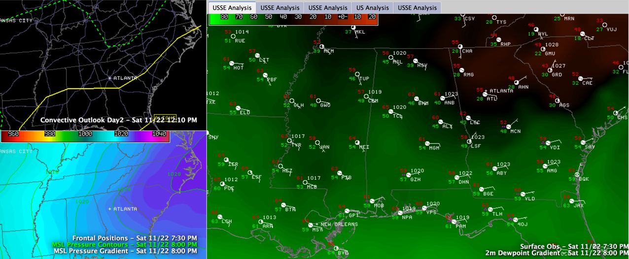
After a very nice late fall Saturday across Central Alabama today with highs in the upper 60s to near 70F and lots of sunshine, thin high clouds are overspreading the area this evening. The clouds are patchy, so you can still see some stars through them. Temperatures are still mild, running around 60F. But the […]

Read More