Watches, We Got Watches

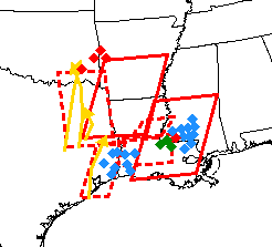
Several tornado watches that have been in effect are basically going to be consolidated into two big ones as the older watches expired at 8 p.m. or will expire at 9 p.m.
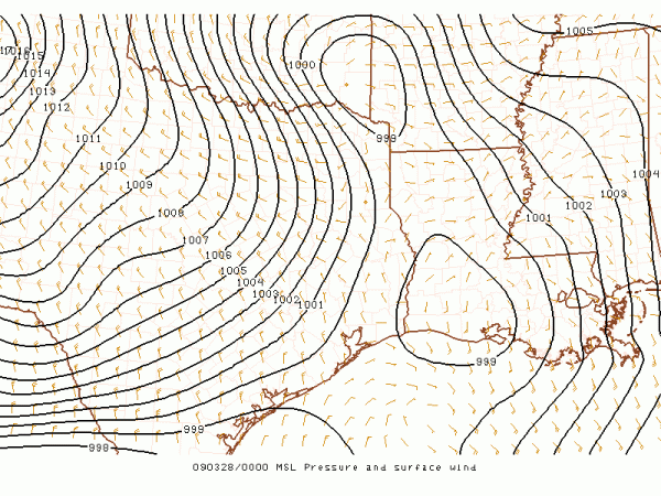
Two surface lows have developed. The first, close to the upper low, it west of Texarkana tonight. It is expected to be over northwestern Mississippi by early Saturday morning. By that time, the cold front will be near the Mississippi River.

Thunderstorms will continue to develop over Arkansas, northeastern Texas and Louisiana tonight with this system as it moves eastward. On this radar composite, you can see storms over southwestern Louisiana, a line of storms over northwestern Louisiana and some earlier tornadic storms near the low along the Oklahoma/Arkansas border.
This activity will spread into Alabama early Saturday morning. Strong wind fields and colder air aloft will set the stage for active weather, including all modes of severe weather.
To the south, the other low is associated with a large complex of storms over southern Mississippi. This large complex will continue to spread eastward across southern Mississippi and inoto Southwest Alabama later this evening. There will be an enhanced threat of severe weather, including tornadoes with this activity.
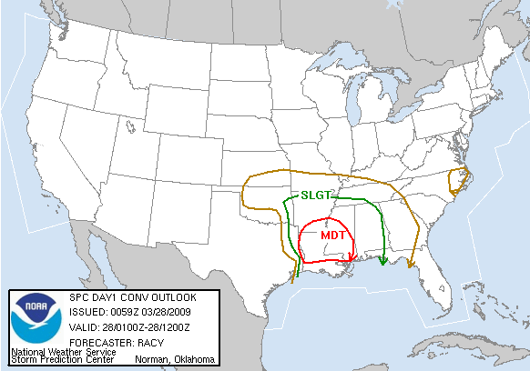
Here is the new convective outlook from the SPC.

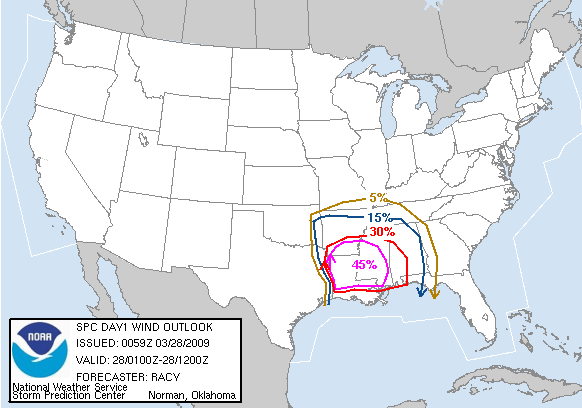
Here is the probabilistic severe wind threat…

Category: Uncategorized


