

Alabama Update at 9:45 a.m.
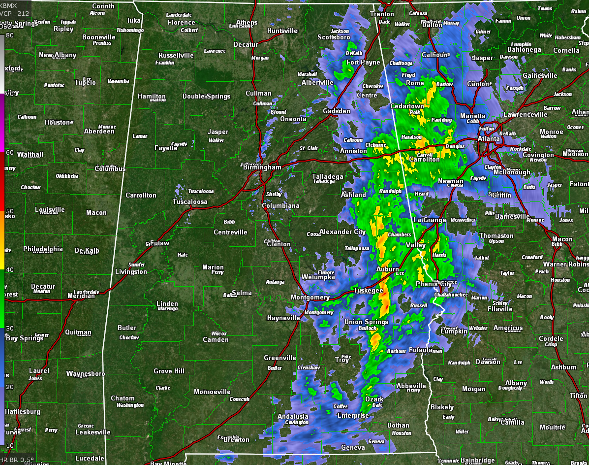
A line of showers and storms continues pushing east across East Alabama this morning. It extends from parts of Jackson and DeKalb Counties through Etowah and Calhoun into Randolph, Clay, Tallapoosa, Chambers, Macon, Lee, Russell, Bullock, to Dale County in Southeast Alabama.
The strongest storms are just south of I-85 in Macon County. These storms will be working up into the Auburn/Opelika area with gusty winds, heavy rain, and lightning. A significant weather advisory has just been posted for parts of Lee, Macon, and Russell Counties.
Overall, the lightning in the line has decreased over the past hour, showing a general weakening trend.
Our cold front is bowing along a line from Hamilton to Tuscaloosa to Selma to Brewton. It will continue pushing east and southeast.
Skies are clearing behind the front fairly quickly and most areas will see sunshine within an hour or so of its passage. This will allow afternoon readings to warm into the 70s in most locations. Lows tonight will be in the upper 30s/lower 40s North, to middle 40s Central.
Saturday highs will be in the 50s with a chance of showers for some areas. One area will be North and Northwest Alabama, where a new upper low will be moving to our northwest. The other is for areas southeast of I-59 as a surface low energizes the cold front while it is hanging out over the Gulf of Mexico tomorrow. Sunday will be a tad cooler. Next week looks dry til Thursday.
Category: Alabama's Weather, ALL POSTS
About the Author (Author Profile)
Bill Murray is the President of The Weather Factory. He is the site's official weather historian and a weekend forecaster. He also anchors the site's severe weather coverage. Bill Murray is the proud holder of National Weather Association Digital Seal #0001 @wxhistorianSubscribe
If you enjoyed this article, subscribe to receive more just like it.


