

Here is a Look at the Alabama Weather Situation at Midnight
We continue to monitor storms tonight from southeastern Louisiana and southern Mississippi into Southwest Alabama.
There were a few tornado warnings in Louisiana, but the storms have weakened over the past couple of hours. The NWS in New Orleans maintains one severe thunderstorm warning at this hour for the area from Amite City to Franklinton to Bogalusa. This storm will be moving into southern Mississippi shortly. You can see the copious amounts of lightning associated with the storms.
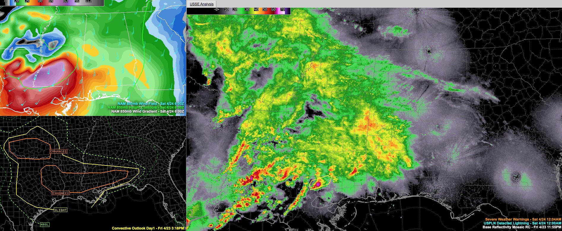
Heavy rain and storms are now over West Alabama from Aliceville and Geiger to Eutaw, Demopolis. and back to York. Very heavy rain is falling with this activity.
There is a tornado watch for much of southwestern Mississippi and southeastern Louisiana until 4 a.m. It is not known at this time whether a watch will be required later for parts of Alabama, but that is certainly a possibility.
Whether the storms can become more organized and strengthen over the next few hours depends on the development of a low level jet from southern Mississippi into southwestern Alabama. We can see signs of that beginning to happen on the 3 km NAM model in the top left panel of the graphic.
If storms are able to strengthen, with the help of that developing 850 millibar jet, there could be damaging winds and a couple of tornadoes through the overnight hours mainly along and south of US-80 from Demopolis to Selma to Montgomery and Eufaula.
North of that, a few reports of hail and strong winds could occur up to the vicinity of I-20, but the further north you go, the chances lessen.
Heavy rain and loud thunder will accompany the storms. Many spots could pick up 1-2 inches of rain with some 3 inch amounts possible.
Make sure you have multiple ways of hearing warnings overnight, including methods that will wake you if you are sleeping. A NOAA Weatheradio is the baseline standard. Every home should have one.
More storms will develop Saturday afternoon in a warm, and unstable airmass across Alabama. Those storms will be scattered in nature, but will have the capability to produce large hail and damaging winds.
If you are awake during the night, we will have frequent updates on future developments along with any warnings until the event is over.
Category: Alabama's Weather, ALL POSTS, Severe Weather
About the Author (Author Profile)
Bill Murray is the President of The Weather Factory. He is the site's official weather historian and a weekend forecaster. He also anchors the site's severe weather coverage. Bill Murray is the proud holder of National Weather Association Digital Seal #0001 @wxhistorianSubscribe
If you enjoyed this article, subscribe to receive more just like it.


