

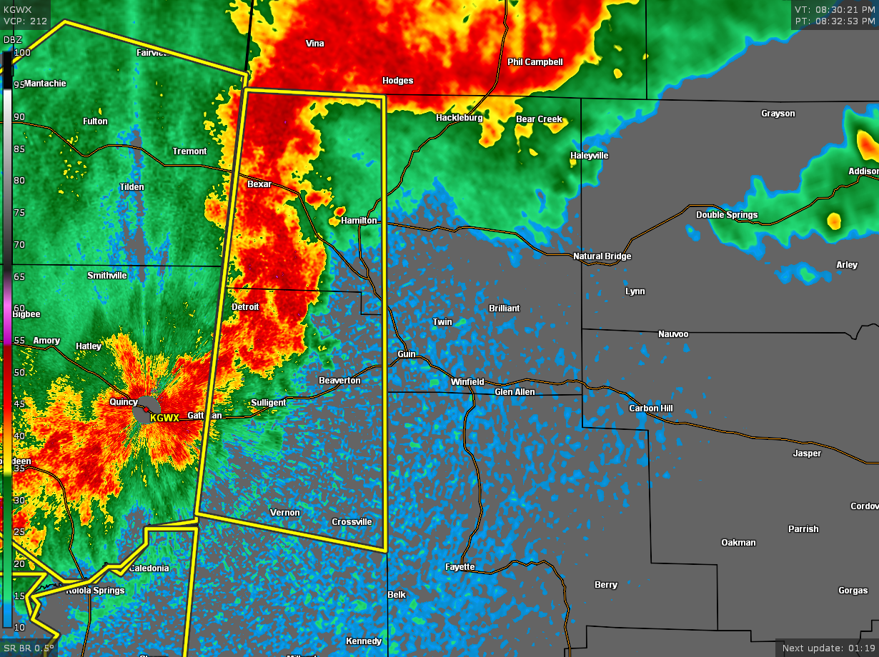
Strong Storms Affecting Portions of Winston, & Marion Counties; Soon to Move Into Fayette County
…SIGNIFICANT WEATHER ADVISORY FOR MARION AND NORTHWESTERN FAYETTE
COUNTIES UNTIL 915 PM CDT…
At 829 PM CDT, Doppler radar was tracking strong thunderstorms along
a line extending from 9 miles north of Weston to near Lamar County
Airport. Movement was east at 45 mph.
Winds in excess of 40 mph will be possible with these storms.
Locations impacted include…
Hamilton, Winfield, Fayette, Haleyville, Guin, Hackleburg, Brilliant,
Glen Allen, Gu-
Win, Bluff, Brinn, Lake Buttahatchee, Bear Creek, Twin, Tucker,
Wayside, Upper Bear Creek Reservoir, Piney Grove, Bazemore and
Tessner.
…SIGNIFICANT WEATHER ADVISORY FOR WINSTON COUNTY UNTIL 930 PM
CDT…
At 831 PM CDT, Doppler radar was tracking strong thunderstorms along
a line extending from 9 miles northeast of Needmore to Weston.
Movement was southeast at 45 mph.
Winds in excess of 40 mph will be possible with these storms.
Locations impacted include…
Haleyville, Lynn, Arley, Double Springs, Addison, Nauvoo, Houston
Recreational Area, Camp McDowell, Nesmith, Ashbank, Brushy Lake,
Poplar Springs, Ashridge, Falls City, Moreland, Smith Lake, Helicon,
Inmanfield, Sardis and Corinth Rec Area.
Category: Alabama's Weather, ALL POSTS, Severe Weather
About the Author (Author Profile)
Scott Martin is an operational meteorologist, professional graphic artist, musician, husband, and father. Not only is Scott a member of the National Weather Association, but he is also the Central Alabama Chapter of the NWA president. Scott is also the co-founder of Racecast Weather, which provides forecasts for many racing series across the USA. He also supplies forecasts for the BassMaster Elite Series events including the BassMaster Classic.Subscribe
If you enjoyed this article, subscribe to receive more just like it.


