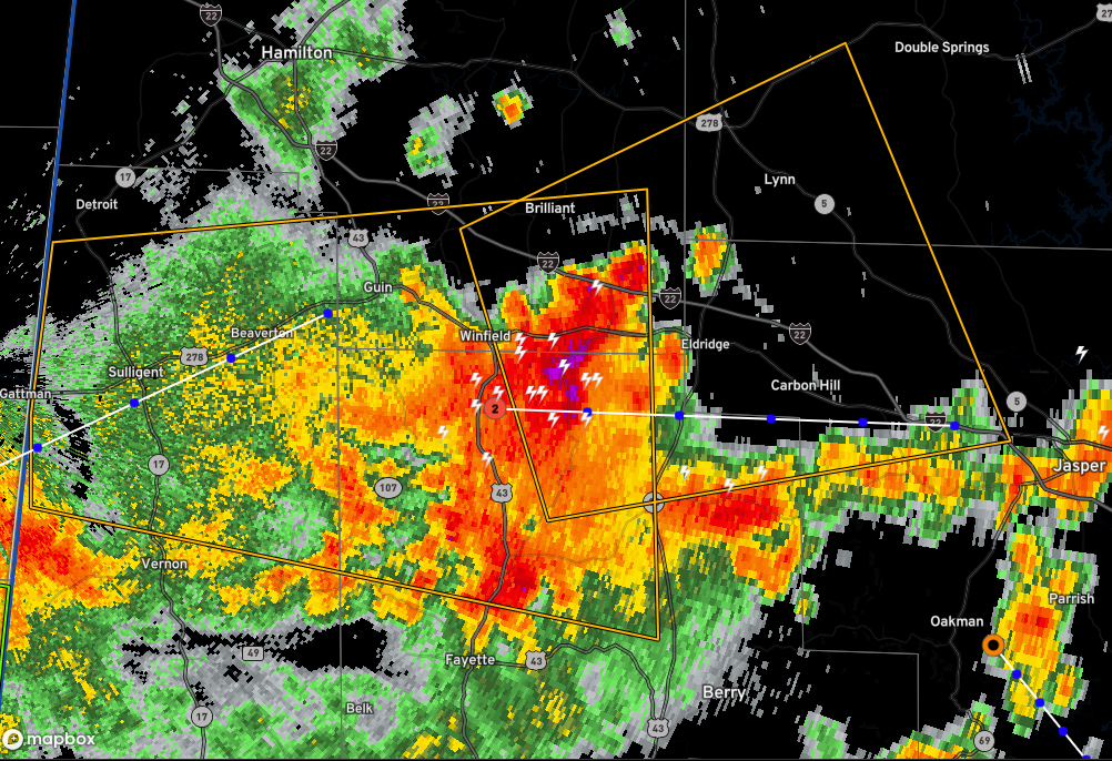
Severe Thunderstorm Warning for Parts of Walker, Marion, Winston, and Fayette Counties Until 1 p.m.
The National Weather Service in Birmingham has issued a
* Severe Thunderstorm Warning for…
Northwestern Walker County in central Alabama…
Southeastern Marion County in northwestern Alabama…
Southwestern Winston County in northwestern Alabama…
Northeastern Fayette County in west central Alabama…
* Until 100 PM CDT.
* At 1210 PM CDT, a severe thunderstorm was located over Glen Allen,
or near Winfield, moving east at 15 mph.
HAZARD…60 mph wind gusts and quarter size hail.
SOURCE…Radar indicated.
IMPACT…Hail damage to vehicles is expected. Expect wind damage
to roofs, siding, and trees.
* Locations impacted include…
Winfield, Carbon Hill, Lynn, Brilliant, Glen Allen, Kansas, Nauvoo,
Eldridge, Ashbank, Natural Bridge, Tucker, Bazemore, Hubbertville,
Cedrum Area, Texas, Holly Grove and Lupton.
Category: Alabama's Weather, ALL POSTS, Severe Weather
About the Author (Author Profile)
Bill Murray is the President of The Weather Factory. He is the site's official weather historian and a weekend forecaster. He also anchors the site's severe weather coverage. Bill Murray is the proud holder of National Weather Association Digital Seal #0001 @wxhistorianSubscribe
If you enjoyed this article, subscribe to receive more just like it.


